
City
Baotou
China
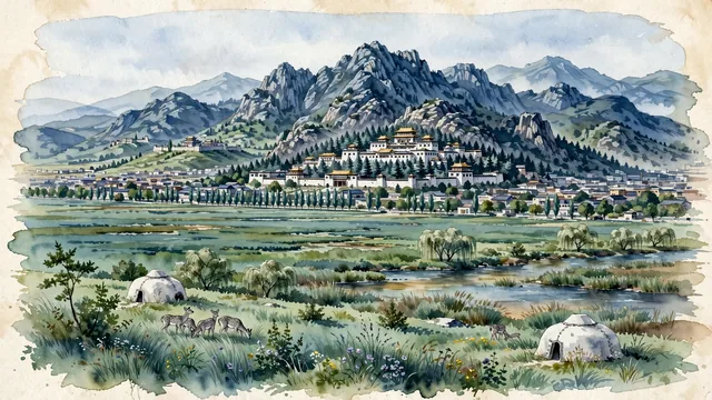
What guided this image
- Landmarks
- Wudangzhao Monastery; Saihan Tala; Yellow River; Daqing Mountains; Meidaizhao Monastery; Tibetan Buddhist
- Viewpoint
- Favor the classic viewpoint looking toward the Yin Mountains across the Saihan Tala grasslands or looking into the valley of Wudangzhao Monastery, showing steppe grasses and white gers in the foreground, the whitewashed multi-tiered Tibetan temple halls in the middle-ground, and the jagged granite ridges of the Yin Mountains rising in the background.
- Palette
- Green should be the predominant color, especially in the vast urban steppe grasses of Saihan Tala, willow marshes along the Yellow River, and pine groves around Wudangzhao.
- Guarded against
- Not Hohhot, Ordos, or Yinchuan
Population2,150,000Wikidata: 2,650,364
Coordinates40.65°N, 109.84°E
Elevation1,065 m
Area27,571 km²
Time zoneAsia/ShanghaiUTC+8
Solar noon12:41clock runs 0.7 h ahead of the sun
Through the Earth
Dig straight through the Earth from Baotou and you surface nearest to Comallo, Argentina — 43 km from the exact antipodal point.
Nearest cities in the atlas
| Ordos | CN | 116 km |
| Hohhot | CN | 154 km |
| Bayan Nur | CN | 207 km |
| Datong | CN | 299 km |
| Lüliang | CN | 366 km |
| Taiyuan | CN | 388 km |
| Yinchuan | CN | 390 km |
| Jinzhong | CN | 415 km |
Twinned cities
Wikidata records no twinned cities for Baotou inside this atlas.