
City
Batam
Indonesia
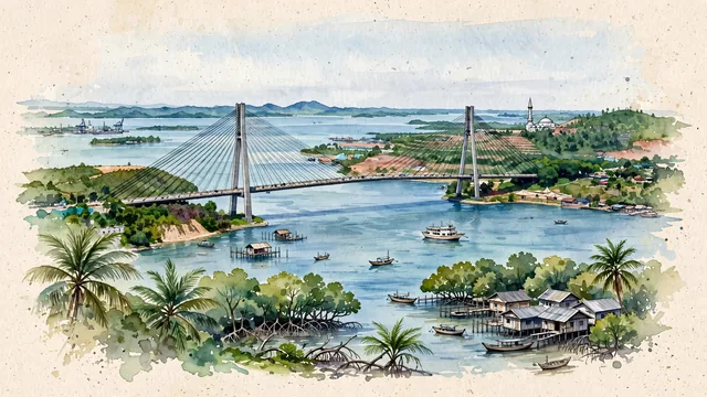
What guided this image
- Landmarks
- Barelang Bridge; Sultan Mahmud Riayat Syah Mosque; Bukit Senyum; Malay; lush tropical island greenery; Malay
- Viewpoint
- Favor the classic elevated coastal viewpoint looking toward Barelang Bridge 1 across the sea channel, showing tropical foliage and coastal rocks in the foreground, the sweeping cable-stayed bridge and wooden pompong boats in the middle-ground, and the rolling green islands receding into the background.
- Palette
- Green should be the predominant color, especially in the thick tropical rainforest and mangrove estuaries of Batam and Tonton islands, coastal palms, and hill slopes.
- Guarded against
- Avoid confusing Batam with Singapore (no Marina Bay Sands or futuristic supertrees; Batam is an Indonesian island of lush green hills, Barelang cable bridges, and coastal Malay villages).
Population1,296,960Wikidata: 1,196,396
Coordinates1.15°N, 104.02°E
Elevation38 m
Area1,595 km²
Time zoneAsia/JakartaUTC+7
Solar noon12:04clock runs 0.1 h ahead of the sun
Through the Earth
Dig straight through the Earth from Batam and you surface nearest to Tiputini, Ecuador — 64 km from the exact antipodal point.
Nearest cities in the atlas
| Singapore | SG | 24 km |
| Pekanbaru | ID | 295 km |
| Kuala Lumpur | MY | 341 km |
| Palembang | ID | 460 km |
| Medan | ID | 653 km |
| Bandar Lampung | ID | 745 km |
| Tangerang | ID | 865 km |
| Jakarta | ID | 877 km |
Twinned cities
Wikidata records no twinned cities for Batam inside this atlas.