
City
Changsha
China
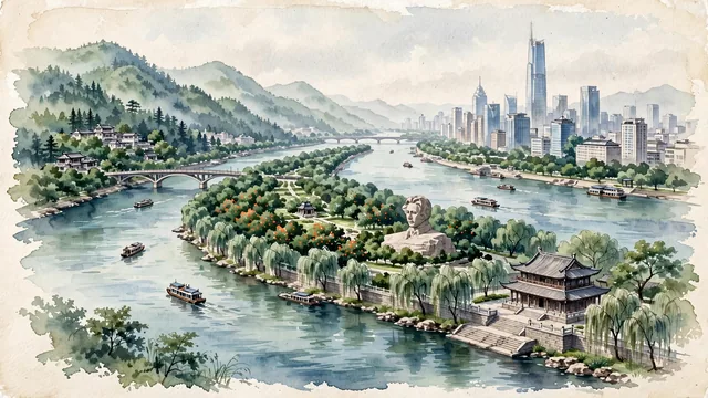
What guided this image
- Landmarks
- Young Mao Zedong Sculpture; Orange Isle; Mount Yuelu; Fu River Pavilion; Furong and Tianxin; Xiang River; lush central Chinese flora; Chu-Han
- Viewpoint
- Favor the classic viewpoint looking across the Xiang River toward Orange Isle and Mount Yuelu (such as from the Du Fu Pavilion embankment), showing river stone steps and willows in the foreground, the green island of Juzizhou and the Youth Statue in the middle-ground, and the lush forested ridge of Mount Yuelu rising in the background.
- Palette
- Green should be the predominant color, especially in the thick pine and maple forests of Mount Yuelu, orange groves of Juzizhou, and riverbank willows.
- Guarded against
- Not Wuhan, Guangzhou, or Nanchang
Population3,093,980Wikidata: 8,154,700
Coordinates28.20°N, 112.97°E
Elevation63 m
Area11,816 km²
Time zoneAsia/ShanghaiUTC+8
Solar noon12:28clock runs 0.5 h ahead of the sun
Through the Earth
Dig straight through the Earth from Changsha and you surface nearest to San Blas, Argentina — 24 km from the exact antipodal point.
Nearest cities in the atlas
| Zhuzhou | CN | 45 km |
| Guankou | CN | 65 km |
| Heshan | CN | 73 km |
| Yichun | CN | 146 km |
| Hengyang | CN | 150 km |
| Changde | CN | 155 km |
| Yongzhou | CN | 239 km |
| Jingzhou | CN | 251 km |
Twinned cities
Wikidata records no twinned cities for Changsha inside this atlas.