
City
Hong Kong
Hong Kong
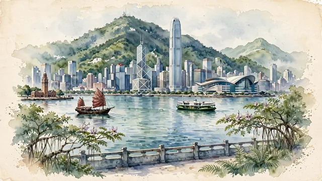
What guided this image
- Landmarks
- Victoria Harbour; Hong Kong Convention and Exhibition Centre; the world-renowned skyscraper skyline; Clock Tower; Victoria Peak; Lion Rock; lush South China coastal flora; Cantonese
- Viewpoint
- Favor the classic viewpoint from the Tsim Sha Tsui waterfront promenade looking south across Victoria Harbour toward Hong Kong Island, showing promenade stone balustrades and palm fronds in the foreground, a traditional wooden junk and Star Ferry navigating the water in the middle-ground, and the magnificent skyline backed by Victoria Peak rising in the background.
- Palette
- Green should be the predominant color, especially in the thick subtropical rainforest covering Victoria Peak, the jade-green waters of Victoria Harbour, and harborfront banyans.
- Guarded against
- Not Shanghai, Singapore, or Tokyo
Population7,396,076Wikidata: 3,129,648
Coordinates22.28°N, 114.17°E
Elevation7 m
Area1,106 km²
Time zoneAsia/Hong_KongUTC+8
Solar noon12:23clock runs 0.4 h ahead of the sun
Through the Earth
Dig straight through the Earth from Hong Kong and you surface nearest to La Quiaca, Argentina — 31 km from the exact antipodal point.
Nearest cities in the atlas
| Hong Kong Island | HK | 2 km |
| Kowloon | HK | 5 km |
| New Territories | HK | 17 km |
| Luohu District | CN | 30 km |
| Shenzhen | CN | 32 km |
| Bao'an | CN | 42 km |
| Zhuhai | CN | 62 km |
| Zhongshan | CN | 85 km |
Twinned cities
- Dubai AE
1 of 1 twinned cities are in this atlas. See the full network →