
City
Antananarivo
Capital of Madagascar
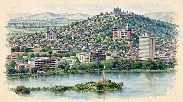
What guided this image
- Landmarks
- The Rova of Antananarivo; Andafiavaratra Palace; Andohalo Cathedral; Lake Anosy; Merina
- Viewpoint
- Use an elevated view from the western side of the Lake Anosy area toward the royal ridge, retaining the densely inhabited slopes that the familiar palace-only postcard leaves out.
- Palette
- Muted botanical green should predominate around Lake Anosy and in the scattered hillside gardens, while slate-grey shadows and subdued earth-neutral roof washes preserve the city’s brick-and-tile character.
- Guarded against
- Avoid making Antananarivo look like a palm-lined Indian Ocean beach city, a baobab-dotted rural landscape, or a European hill town with uniform stone cottages.
Population1,349,501Wikidata: 2,610,000
Coordinates18.91°S, 47.54°E
Elevation1,276 m
Area88,000,000 km²
Time zoneIndian/AntananarivoUTC+3
Solar noon11:50clock runs 0.2 h behind the sun
Through the Earth
Dig straight through the Earth from Antananarivo and you surface in open ocean, nearest to El Morro, Mexico — 2,030 km from the exact antipodal point.
Nearest cities in the atlas
| Moroni | KM | 924 km |
| Port Louis | MU | 1,053 km |
| Lilongwe | MW | 1,565 km |
| Dar es Salaam | TZ | 1,615 km |
| Maputo | MZ | 1,724 km |
| Matola | MZ | 1,735 km |
| Harare | ZW | 1,744 km |
| Victoria | SC | 1,807 km |
Twinned cities
4 of 6 twinned cities are in this atlas. See the full network →
This city sits on
- Madagascarcountry
- 19Sparallel
- UTC+3offset