
City
Banjul
Capital of The Gambia
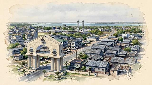
What guided this image
- Landmarks
- Arch 22; Albert Market; King Fahad Mosque; The old Bathurst street grid; Use
- Viewpoint
- Use a modestly elevated view from the western approach near Arch 22 toward the island city and estuary, placing the familiar gateway within the wider low-rise capital instead of presenting it as an isolated national symbol.
- Palette
- Muted botanical green should predominate in the actual scattered trees and distant wetland vegetation, with blue-grey estuary water and slate-grey roofs leaving the central city visibly built-up rather than falsely lush.
- Guarded against
- Avoid making Banjul look like Dakar with a prominent modern coastal skyline, the resort strip of nearby Senegambia, or a dune-ringed Saharan town.
Population37,274Wikidata: 31,356
Coordinates13.45°N, 16.58°W
Elevation0 m
Area12 km²
Time zoneAfrica/BanjulUTC+0
Solar noon13:06clock runs 1.1 h ahead of the sun
Through the Earth
Dig straight through the Earth from Banjul and you surface nearest to Kirakira, Solomon Islands — 371 km from the exact antipodal point.
Nearest cities in the atlas
| Dakar | SN | 166 km |
| Touba | SN | 174 km |
| Bissau | GW | 206 km |
| Nouakchott | MR | 520 km |
| Camayenne | GN | 537 km |
| Conakry | GN | 537 km |
| Freetown | SL | 661 km |
| Praia | CV | 765 km |
Twinned cities
3 of 8 twinned cities are in this atlas. See the full network →
This city sits on
- The Gambiacountry
- 13Nparallel
- UTC+0offset