
City
Belo Horizonte
Brazil
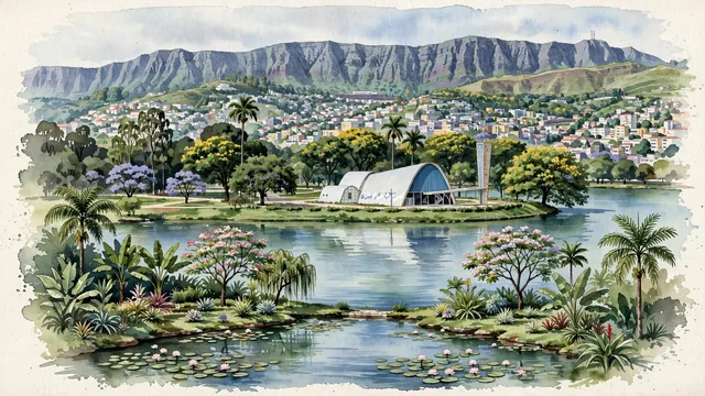
What guided this image
- Landmarks
- Church of Saint Francis of Assisi; Lake Pampulha; Serra do Curral; Praça da Liberdade; Mirante das Mangabeiras; Mangabeiras Park; lush tropical flora; Brazilian
- Viewpoint
- Favor the classic viewpoint from across Lake Pampulha looking toward the Church of São Francisco de Assis, showing water reflections and Burle Marx garden flora in the foreground, the graceful curves of Niemeyer's church in the middle-ground, and the rolling urban hills and Serra do Curral mountain wall in the background.
- Palette
- Green should be the predominant color, especially in the thick eucalyptus and tropical rainforest canopies of Mangabeiras Park, Burle Marx gardens, and roadside ipês.
- Guarded against
- Avoid confusing Belo Horizonte with Rio (no ocean harbor or Christ the Redeemer; Belo Horizonte is an inland highland capital defined by Lake Pampulha and the Serra do Curral).
Population2,721,564Wikidata: 2,513,451
Coordinates19.92°S, 43.94°W
Elevation760 m
Area331 km²
Time zoneAmerica/Sao_PauloUTC−3
Solar noon11:56clock runs 0.1 h behind the sun
Through the Earth
Dig straight through the Earth from Belo Horizonte and you surface in open ocean, nearest to Zaisho, Japan — 822 km from the exact antipodal point.
Nearest cities in the atlas
| Rio de Janeiro | BR | 342 km |
| Campinas | BR | 463 km |
| Guarulhos | BR | 476 km |
| São Paulo | BR | 491 km |
| Brasília | BR | 625 km |
| Goiânia | BR | 666 km |
| Curitiba | BR | 821 km |
| Salvador | BR | 966 km |
Twinned cities
6 of 12 twinned cities are in this atlas. See the full network →