
City
São Paulo
Brazil
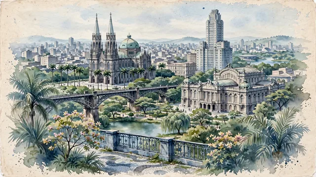
What guided this image
- Landmarks
- São Paulo Cathedral; Viaduto do Chá; Italian Baroque and Art Nouveau; Art Deco Altino Arantes; Ibirapuera Park; Atlantic plateau flora; South American
- Viewpoint
- Favor the classic viewpoint looking across the landscape toward the signature landmarks of São Paulo, showing regional foliage and foreground textures, the iconic architectural monuments in the middle-ground, and the distant horizon fading in the background.
- Palette
- Green should be the predominant color, especially in towering imperial palms on Praça da Sé, flowering ipê trees, and tipuana trees in Vale do Anhangabaú.
Population12,400,232Wikidata: 11,895,893
Coordinates23.55°S, 46.64°W
Elevation760 m
Area1,523 km²
Time zoneAmerica/Sao_PauloUTC−3
Solar noon12:07clock runs 0.1 h ahead of the sun
Through the Earth
Dig straight through the Earth from São Paulo and you surface nearest to Zaisho, Japan — 332 km from the exact antipodal point.
Nearest cities in the atlas
| Guarulhos | BR | 15 km |
| Campinas | BR | 83 km |
| Curitiba | BR | 338 km |
| Rio de Janeiro | BR | 361 km |
| Belo Horizonte | BR | 491 km |
| Goiânia | BR | 811 km |
| Porto Alegre | BR | 852 km |
| Brasília | BR | 874 km |
Twinned cities
- Abidjan CI
- Amman JO
- Arequipa PE
- Asunción PY
- Bamako ML
- Barcelona ES
- Beijing CN
- Bucharest RO
- Budapest HU
- Buenos Aires AR
- Chicago US
- Damascus SY
- Hamburg DE
- Havana CU
- İzmir TR
- La Paz BO
- Lima PE
- Lisbon PT
- Luanda AO
- Mexico City MX
- Milan IT
- Monterrey MX
- Montevideo UY
- Ningbo CN
- Osaka JP
- Santiago CL
- Seoul KR
- Shanghai CN
- Tokyo JP
- Toronto CA
- Yerevan AM
31 of 53 twinned cities are in this atlas. See the full network →