
City
İzmir
Turkey
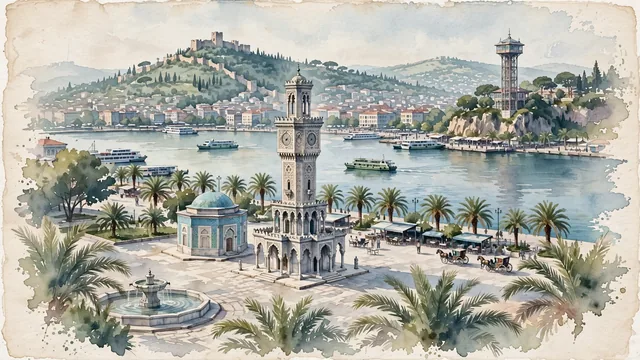
What guided this image
- Landmarks
- Konak Clock Tower; Yalı Mosque; Kordon; Tarihi Asansör; Kadifekale; Gulf of İzmir; lush Aegean Mediterranean flora; Smyrna
- Viewpoint
- Favor the classic viewpoint looking across Konak Square toward the Clock Tower with the Gulf of İzmir and coastal hills in the background, showing date palm fronds and stone pavers in the foreground, the delicate marble Clock Tower, Yalı Mosque, and square in the middle-ground, and the calm bay waters and distant hills of Karşıyaka fading in the background.
- Palette
- Green should be the predominant color, especially in the thick date palm groves along the Kordon and Konak Square, pine trees on Kadifekale, and hillside olive groves.
- Guarded against
- Not Istanbul, Antalya, or Bodrum
Population2,938,292Wikidata: 1,489,817
Coordinates38.41°N, 27.14°E
Elevation2 m
Area944 km²
Time zoneEurope/IstanbulUTC+3
Solar noon13:11clock runs 1.2 h ahead of the sun
Through the Earth
Dig straight through the Earth from İzmir and you surface in open ocean, nearest to Mataura, French Polynesia — 1,705 km from the exact antipodal point.
Nearest cities in the atlas
| Bursa | TR | 259 km |
| Athens | GR | 302 km |
| Istanbul | TR | 328 km |
| Antalya | TR | 355 km |
| Konya | TR | 471 km |
| Ankara | TR | 520 km |
| Sofia | BG | 576 km |
| Skopje | MK | 628 km |
Twinned cities
- Baku AZ
- Bishkek KG
- Cape Town ZA
- Chengdu CN
- Havana CU
- Mumbai IN
- São Paulo BR
- Sarajevo BA
- Shymkent KZ
- Skopje MK
- Surabaya ID
- Tianjin CN
- Volgograd RU
- Wuhan CN
- Xiamen CN
15 of 37 twinned cities are in this atlas. See the full network →