
City
Sarajevo
Capital of Bosnia and Herzegovina
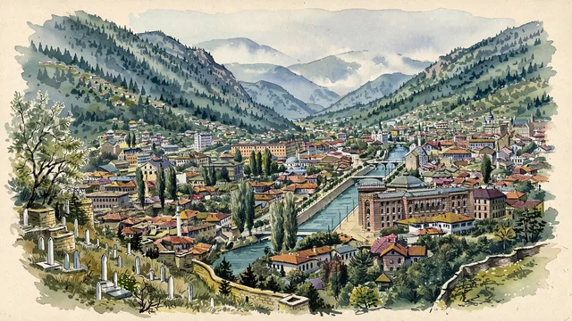
What guided this image
- Landmarks
- Baščaršija; Gazi Husrev-beg Mosque; National and University Library of Bosnia and Herzegovina; Miljacka River; Sacred Heart Cathedral; Yellow Fortress
- Viewpoint
- Favor the classic elevated viewpoint from the Yellow Fortress (Žuta Tabija) or the slopes of Vratnik, looking west down the Miljacka valley, showing Baščaršija rooftops and minarets in the foreground/middle-ground, the Vijećnica along the river, and the forested slopes of Mount Trebević framing the valley.
- Palette
- Green should be the predominant color, especially in the steep forested mountain slopes of Trebević, hillside pastures, and riverbank willows.
- Guarded against
- Not a generic Balkan or Central European city
Population696,731Wikidata: 275,524
Coordinates43.85°N, 18.36°E
Elevation518 m
Area142 km²
Time zoneEurope/SarajevoUTC+1
Solar noon11:47clock runs 0.2 h behind the sun
Through the Earth
Dig straight through the Earth from Sarajevo and you surface in open ocean, nearest to Waitangi, New Zealand — 1,194 km from the exact antipodal point.
Nearest cities in the atlas
| Podgorica | ME | 173 km |
| Belgrade | RS | 198 km |
| Pristina | XK | 263 km |
| Zagreb | HR | 288 km |
| Tirana | AL | 305 km |
| Skopje | MK | 324 km |
| Ljubljana | SI | 389 km |
| Budapest | HU | 409 km |
Twinned cities
- Amman JO
- Amsterdam NL
- Ankara TR
- Astana KZ
- Athens GR
- Baku AZ
- Barcelona ES
- Budapest HU
- Bursa TR
- Cairo EG
- Calgary CA
- Istanbul TR
- İzmir TR
- Konya TR
- Kuwait City KW
- Kyiv UA
- Ljubljana SI
- Madrid ES
- Mexico City MX
- Skopje MK
- Tianjin CN
- Tirana AL
- Tripoli LY
- Zagreb HR
24 of 43 twinned cities are in this atlas. See the full network →
This city sits on
- Bosnia and Herzegovinacountry
- 43Nparallel
- UTC+1offset