
City
Cairo
Capital of Egypt
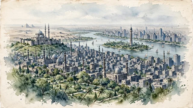
What guided this image
- Landmarks
- Mosque of Muhammad Ali; Sultan Hassan and Al-Rifa'i; Nile; Cairo Tower; Belle Époque and Art Deco; Al-Azhar Park; Giza; Belle Époque
- Viewpoint
- Favor a slightly elevated viewpoint from the hillside gardens of Al-Azhar Park, looking west across the domes and minarets of historic Cairo, with the Citadel to one side and the modern city, the Nile, and the distant pyramids beyond.
- Palette
- Green should be the predominant painted color, concentrated where it naturally belongs: Al-Azhar Park, the palms and gardens along the Nile, and the river islands.
- Guarded against
- Avoid making Cairo look like Istanbul (the Muhammad Ali Mosque is Ottoman in style, but the city around it is not), Dubai, Marrakech, or a generic desert town, and avoid Mediterranean or Alpine character.
Population9,606,916Wikidata: 9,717,324
Coordinates30.06°N, 31.25°E
Elevation23 m
Area528 km²
Time zoneAfrica/CairoUTC+2
Solar noon11:55clock runs 0.1 h behind the sun
Through the Earth
Dig straight through the Earth from Cairo and you surface in open ocean, nearest to Mataura, French Polynesia — 750 km from the exact antipodal point.
Nearest cities in the atlas
| Giza | EG | 7 km |
| Shubrā al Khaymah | EG | 8 km |
| Alexandria | EG | 180 km |
| Jerusalem | IL | 424 km |
| East Jerusalem | PS | 425 km |
| Ramallah | PS | 429 km |
| Amman | JO | 495 km |
| Beirut | LB | 585 km |
Twinned cities
- Algiers DZ
- Amman JO
- Baghdad IQ
- Barcelona ES
- Beijing CN
- Beirut LB
- Buenos Aires AR
- Casablanca MA
- Damascus SY
- Houston US
- Isfahan IR
- Istanbul TR
- Jeddah SA
- Khartoum SD
- Lagos NG
- Mexico City MX
- Minsk BY
- Moscow RU
- New York City US
- Ottawa CA
- Paris FR
- Rabat MA
- Sarajevo BA
- Seoul KR
- Tbilisi GE
- Xi’an CN
26 of 31 twinned cities are in this atlas. See the full network →