
City
Seoul
Capital of South Korea
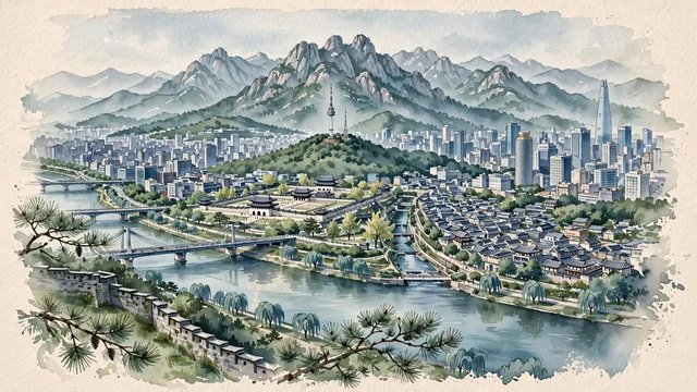
What guided this image
- Landmarks
- N Seoul Tower; Joseon; Bukchon Hanok Village; Han River; Cheonggyecheon; Gangnam; Bukhansan and Inwangsan; lush parkland greenery
- Viewpoint
- Favor an elevated viewpoint looking north from the slopes of Mount Namsan or across the Han River from Yeouido, showing the river and bridges in the foreground/middle-ground, the downtown skyline and Gyeongbokgung roofs in the middle-ground, and the dramatic granite crests of Bukhansan dominating the background.
- Palette
- Green should be the predominant color, especially in the pine forests of Mount Namsan, palace gardens, riverside parks, and Bukhansan slopes.
- Guarded against
- Not Tokyo, Beijing, or a generic Asian metropolis
Population10,349,312Wikidata: 9,668,465
Coordinates37.57°N, 126.98°E
Elevation38 m
Area605 km²
Time zoneAsia/SeoulUTC+9
Solar noon12:32clock runs 0.5 h ahead of the sun
Through the Earth
Dig straight through the Earth from Seoul and you surface nearest to Mar de Ajó, Argentina — 338 km from the exact antipodal point.
Nearest cities in the atlas
| Goyang-si | KR | 16 km |
| Incheon | KR | 27 km |
| Suwon | KR | 31 km |
| Daejeon | KR | 140 km |
| Pyongyang | KP | 195 km |
| Daegu | KR | 237 km |
| Gwangju | KR | 269 km |
| Changwon | KR | 301 km |
Twinned cities
- Ankara TR
- Astana KZ
- Athens GR
- Bandung ID
- Bangkok TH
- Beijing CN
- Bogotá CO
- Buenos Aires AR
- Cairo EG
- Delhi IN
- Hanoi VN
- Jakarta ID
- Kyiv UA
- Mexico City MX
- Moscow RU
- New Delhi IN
- New York City US
- Paris FR
- Rio de Janeiro BR
- Rome IT
- São Paulo BR
- Sydney AU
- Taipei TW
- Tehran IR
- Tirana AL
- Tokyo JP
- Ulan Bator MN
- Warsaw PL
- Washington US
29 of 33 twinned cities are in this atlas. See the full network →
This city sits on
- South Koreacountry
- 37Nparallel
- UTC+9offset