
City
Bogotá
Capital of Colombia
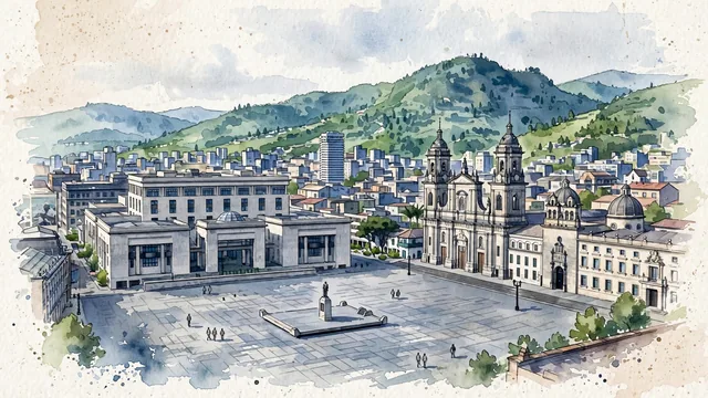
What guided this image
- Landmarks
- Plaza de Bolívar; The Primatial Cathedral of Bogotá; The National Capitol; The statue of Simón Bolívar; Candelaria’s
- Viewpoint
- Use a slightly raised view from the northwestern side of Plaza de Bolívar toward the cathedral and the hills to the east, retaining the square’s true paving instead of using a west-facing Monserrate panorama with the mountains incorrectly placed behind the city.
- Palette
- Muted botanical green should predominate on the real Eastern Hills and in small planted pockets beyond the square, with slate-grey civic stone and blue-grey roof shadows keeping the paved center honest.
- Guarded against
- Avoid making Bogotá look like tropical Cartagena with a Caribbean sea, Cusco with Inca stone terraces, or Medellín with a narrow, steep-sided valley composition.
Population7,674,366Wikidata: 7,200,000
Coordinates4.61°N, 74.08°W
Elevation2,582 m
Area1,578 km²
Time zoneAmerica/BogotaUTC−5
Solar noon11:56clock runs 0.1 h behind the sun
Through the Earth
Dig straight through the Earth from Bogotá and you surface nearest to Surabaya, Indonesia — 22 km from the exact antipodal point.
Nearest cities in the atlas
| Medellín | CO | 246 km |
| Cali | CO | 301 km |
| Barranquilla | CO | 711 km |
| Maracaibo | VE | 724 km |
| Quito | EC | 730 km |
| Panama City | PA | 773 km |
| Barquisimeto | VE | 799 km |
| Valencia | VE | 911 km |
Twinned cities
- Amsterdam NL
- Athens GR
- Brasília BR
- Buenos Aires AR
- Chicago US
- Dubai AE
- La Paz BO
- London GB
- Madrid ES
- Mexico City MX
- Quito EC
- Ramallah PS
- Seoul KR
- Tegucigalpa HN
- Tripoli LY
15 of 21 twinned cities are in this atlas. See the full network →