
City
Barquisimeto
Venezuela
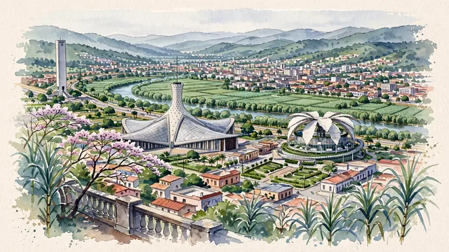
What guided this image
- Landmarks
- Cathedral of Our Lady of Mount Carmel; Flor de Venezuela; Obelisk of Barquisimeto; Sanctuary of the Divina Pastora; Turbio River; Republican; Andes; Marian
- Viewpoint
- Favor the classic elevated viewpoint from Santa Rosa or the plateau bluff looking across the Valle del Turbio toward the city skyline, showing sugarcane fields and trees in the foreground, the hyperbolic white silhouette of the Cathedral and the Flor de Venezuela in the middle-ground, and the blue-gray Andean ridges rising in the background.
- Palette
- Green should be the predominant color, especially in the sugarcane fields of the Valle del Turbio, hillside woods, and apamate trees.
- Guarded against
- Not Caracas, Maracaibo, or Valencia
Population1,240,714Wikidata: 1,059,092
Coordinates10.06°N, 69.36°W
Elevation566 m
Area2,760 km²
Time zoneAmerica/CaracasUTC−4
Solar noon12:37clock runs 0.6 h ahead of the sun
Through the Earth
Dig straight through the Earth from Barquisimeto and you surface nearest to Pacitan, Indonesia — 214 km from the exact antipodal point.
Nearest cities in the atlas
| Valencia | VE | 149 km |
| Maracaibo | VE | 254 km |
| Caracas | VE | 276 km |
| Barranquilla | CO | 601 km |
| Bogotá | CO | 799 km |
| Medellín | CO | 804 km |
| Saint George's | GD | 859 km |
| Port of Spain | TT | 860 km |
Twinned cities
Wikidata records no twinned cities for Barquisimeto inside this atlas.