
City
Saint George's
Capital of Grenada
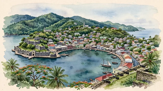
What guided this image
- Landmarks
- Carenage; Fort George; Saint George's Anglican Church; Carenage; Sendall Tunnel; British and French; tropical flora; British Georgian
- Viewpoint
- Favor the classic elevated viewpoint overlooking the Carenage from the heights (such as from Fort Frederick or the hospital hill), looking across the sheltered basin toward Fort George and the open Caribbean Sea, with the colorful colonial warehouses and church spires lining the hillsides.
- Palette
- Green should be the predominant color, especially in the steep rainforest hills behind the town, hillside gardens, and palm groves.
- Guarded against
- Not a generic island town
Population7,500Wikidata: 4,315
Coordinates12.05°N, 61.75°W
Elevation30 m
Time zoneAmerica/GrenadaUTC−4
Solar noon12:07clock runs 0.1 h ahead of the sun
Through the Earth
Dig straight through the Earth from Saint George's and you surface nearest to Kahale, Indonesia — 277 km from the exact antipodal point.
Nearest cities in the atlas
| Kingstown | VC | 136 km |
| Port of Spain | TT | 155 km |
| Castries | LC | 231 km |
| Bridgetown | BB | 259 km |
| Roseau | DM | 363 km |
| Saint John’s | AG | 564 km |
| Caracas | VE | 586 km |
| Basseterre | KN | 593 km |
Twinned cities
Wikidata records no twinned cities for Saint George's inside this atlas.