
City
Bridgetown
Capital of Barbados
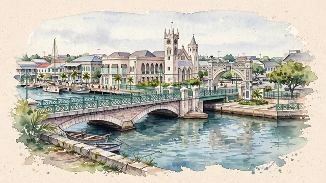
What guided this image
- Landmarks
- The Parliament Buildings; The Careenage; Chamberlain Bridge; Independence Arch; Historic British
- Viewpoint
- Use the familiar view from the southern Careenage quay toward Chamberlain Bridge and the Parliament frontage, retaining working quays and ordinary buildings so the scene shows a real port center rather than a generic Caribbean beach.
- Palette
- Muted botanical green should lead the actual waterfront trees and quiet reflections, with blue-green Careenage water and slate-grey roofs balancing the pale coral-stone architecture.
- Guarded against
- Avoid making Bridgetown look like Havana with a Spanish colonial waterfront, Curaçao with a continuous row of bright Dutch gables, or Saint Lucia beneath steep volcanic pitons.
Population98,511Wikidata: 110,000
Coordinates13.11°N, 59.62°W
Elevation1 m
Area38,849,821 km²
Time zoneAmerica/BarbadosUTC−4
Solar noon11:58clock runs 0.0 h behind the sun
Through the Earth
Dig straight through the Earth from Bridgetown and you surface nearest to Lupe, Indonesia — 305 km from the exact antipodal point.
Nearest cities in the atlas
| Kingstown | VC | 174 km |
| Castries | LC | 180 km |
| Saint George's | GD | 259 km |
| Roseau | DM | 309 km |
| Port of Spain | TT | 341 km |
| Saint John’s | AG | 506 km |
| Basseterre | KN | 572 km |
| Georgetown | GY | 720 km |
Twinned cities
Wikidata records no twinned cities for Bridgetown inside this atlas.