
City
Castries
Capital of Saint Lucia
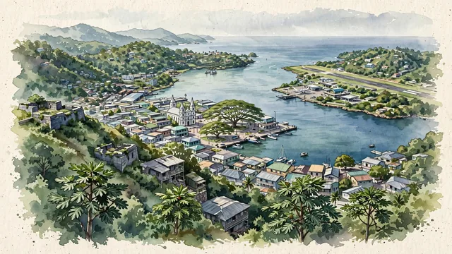
What guided this image
- Landmarks
- Caribbean Sea; Cathedral Basilica of the Immaculate Conception; Derek Walcott Square; Vigie; Morne Fortune
- Viewpoint
- Favor a slightly elevated viewpoint from the slopes of Morne Fortune, looking north across the town and the harbor toward the Vigie peninsula and the sea.
- Palette
- Green should be the predominant color, especially in the steep tropical hills, the trees, and the overall visual impression.
- Guarded against
- Avoid making Castries look like a generic Caribbean resort, a Mediterranean port, or a Latin American colonial city, and avoid Alpine character.
Population20,000Wikidata: 70,000
Coordinates14.00°N, 61.01°W
Elevation2 m
Area79 km²
Time zoneAmerica/St_LuciaUTC−4
Solar noon12:04clock runs 0.1 h ahead of the sun
Through the Earth
Dig straight through the Earth from Castries and you surface nearest to Lailunggi, Indonesia — 443 km from the exact antipodal point.
Nearest cities in the atlas
| Kingstown | VC | 96 km |
| Roseau | DM | 150 km |
| Bridgetown | BB | 180 km |
| Saint George's | GD | 231 km |
| Saint John’s | AG | 358 km |
| Port of Spain | TT | 374 km |
| Basseterre | KN | 410 km |
| Caracas | VE | 748 km |
Twinned cities
- Taipei TW
1 of 1 twinned cities are in this atlas. See the full network →
This city sits on
- Saint Luciacountry
- 14Nparallel
- UTC−4offset