
City
Tegucigalpa
Capital of Honduras
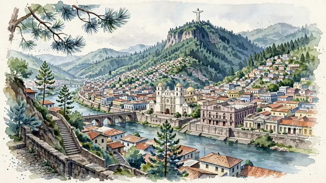
What guided this image
- Landmarks
- Cristo del Picacho; Saint Michael the Archangel Cathedral; Mallol Bridge; Manuel Bonilla National Theatre; Choluteca River
- Viewpoint
- Favor an elevated viewpoint overlooking the valley from Barrio La Leona or the slopes of Comayagüela, looking northeast across the Choluteca River toward the historic center, with the cathedral dome in the middle-ground and the sheer pine-clad peak of El Picacho rising in the background.
- Palette
- Green should be the predominant color, especially in the thick pine forests of El Picacho, La Tigra mountains, and hillside trees.
- Guarded against
- Not a generic Central American or Mexican town
Population850,848Wikidata: 576,661
Coordinates14.08°N, 87.21°W
Elevation990 m
Area202 km²
Time zoneAmerica/TegucigalpaUTC−6
Solar noon11:49clock runs 0.2 h behind the sun
Through the Earth
Dig straight through the Earth from Tegucigalpa and you surface nearest to West Island, Cocos (Keeling) Islands — 486 km from the exact antipodal point.
Nearest cities in the atlas
| San Salvador | SV | 218 km |
| Managua | NI | 240 km |
| Guatemala City | GT | 361 km |
| Belmopan | BZ | 390 km |
| San José | CR | 573 km |
| Mérida | MX | 808 km |
| Panama City | PA | 1,011 km |
| Havana | CU | 1,127 km |
Twinned cities
- Amman JO
- Bogotá CO
- Guadalajara MX
- Guatemala City GT
- Lima PE
- Madrid ES
- Quito EC
- Taipei TW
8 of 10 twinned cities are in this atlas. See the full network →