
City
Guadalajara
Mexico
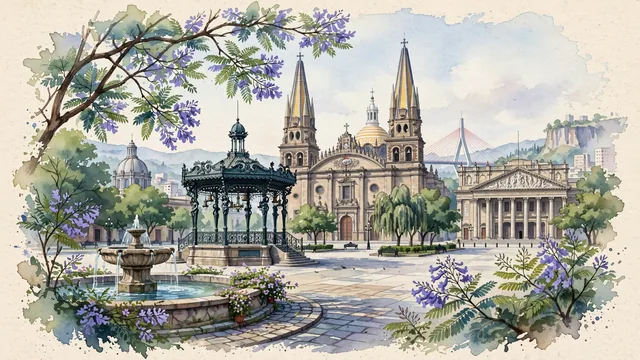
What guided this image
- Landmarks
- Plaza de la Liberación; UNESCO World Heritage Hospicio Cabañas; French Art Nouveau; Teatro Degollado; Puente Matute Remus; Tlaquepaque and Zapopan; Barranca de Huentitán; lush Western Mexican high-plateau flora
- Viewpoint
- Favor the classic viewpoint looking across Plaza de la Liberación or Plaza de Armas toward the Guadalajara Cathedral, showing jacaranda branches and fountain water in the foreground, the French bandstand, stone plaza, and neoclassical colonnades in the middle-ground, and the iconic yellow-tiled twin spires rising majestically against the soft sky in the background.
- Palette
- Green should be the predominant color, especially in the mature jacaranda and ficus tree canopies of the central plazas, Hospicio Cabañas gardens, and canyon rim.
- Guarded against
- Not Mexico City, Monterrey, or Puebla
Population1,385,629Wikidata: 24,560
Coordinates20.68°N, 103.35°W
Elevation1,536 m
Area145 km²
Time zoneAmerica/Mexico_CityUTC−6
Solar noon12:53clock runs 0.9 h ahead of the sun
Through the Earth
Dig straight through the Earth from Guadalajara and you surface in open ocean, nearest to Port Mathurin, Mauritius — 1,385 km from the exact antipodal point.
Nearest cities in the atlas
| Zapopan | MX | 6 km |
| León de los Aldama | MX | 180 km |
| Santiago de Querétaro | MX | 308 km |
| Mexico City | MX | 462 km |
| Ecatepec de Morelos | MX | 464 km |
| Iztapalapa | MX | 472 km |
| Ciudad Nezahualcoyotl | MX | 475 km |
| Puebla | MX | 567 km |
Twinned cities
- Arequipa PE
- Athens GR
- Brasília BR
- Cali CO
- Curitiba BR
- Daejeon KR
- Dublin IE
- Kyoto JP
- Luxembourg LU
- Maracaibo VE
- Milan IT
- Osaka JP
- Panama City PA
- Pristina XK
- Saint Petersburg RU
- San Antonio US
- Tegucigalpa HN
- Washington US
18 of 45 twinned cities are in this atlas. See the full network →