
City
Luxembourg
Capital of Luxembourg
What guided this image
- Landmarks
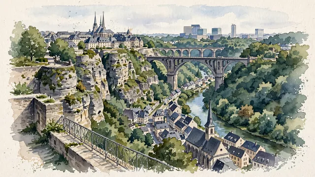
- Adolphe Bridge; Bock Casemates; Saint John's Church; Chemin de la Corniche; Notre-Dame Cathedral; Alzette River; Spanish and Austrian
- Viewpoint
- Favor the classic viewpoint from the Chemin de la Corniche or near the Bock Casemates, looking across the Alzette valley down to the Grund, with the spire of Saint John's Church, stone bridges, and the sandstone fortress cliffs creating a magnificent multi-level composition.
- Palette
- Green should be the predominant color, especially in the densely wooded Pétrusse and Alzette gorges, valley gardens, and cliffside vegetation.
- Guarded against
- Not a generic medieval fortress town or Swiss mountain village
Population76,684Wikidata: 15,091
Coordinates49.61°N, 6.13°E
Elevation300 m
Area51 km²
Time zoneEurope/LuxembourgUTC+1
Solar noon12:35clock runs 0.6 h ahead of the sun
Through the Earth
Dig straight through the Earth from Luxembourg and you surface in open ocean, nearest to Waitangi, New Zealand — 662 km from the exact antipodal point.
Nearest cities in the atlas
| Köln | DE | 158 km |
| Brussels | BE | 187 km |
| Paris | FR | 287 km |
| Bern | CH | 311 km |
| Amsterdam | NL | 319 km |
| Vaduz | LI | 372 km |
| Munich | DE | 431 km |
| London | GB | 490 km |
Twinned cities
- Prague CZ
1 of 3 twinned cities are in this atlas. See the full network →
This city sits on
- Luxembourgcountry
- 49Nparallel
- UTC+1offset