
City
Amsterdam
Capital of Netherlands
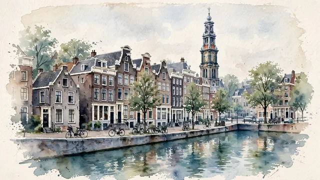
What guided this image
- Landmarks
- Prinsengracht near Westermarkt; Westerkerk; The Anne Frank House frontage; Seventeenth-century canal houses with later alterations; Allow
- Viewpoint
- Use a slightly raised canal-side view along Prinsengracht near Leliegracht toward Westerkerk, a familiar but genuinely representative canal-ring scene when ordinary quays and neighboring houses remain visible.
- Palette
- Muted botanical green should predominate in the real canal trees and their reflections, with blue-green water and slate-grey roof shadows balancing subdued brick and pale window frames.
- Guarded against
- Avoid making Amsterdam look like Venice with gondolas and palazzos, Bruges with an entirely medieval stone skyline, or a rural Dutch windmill-and-tulip scene.
Population741,636Wikidata: 825,080
Coordinates52.37°N, 4.89°E
Elevation-2 m
Area219 km²
Time zoneEurope/AmsterdamUTC+1
Solar noon12:40clock runs 0.7 h ahead of the sun
Through the Earth
Dig straight through the Earth from Amsterdam and you surface in open ocean, nearest to Waitangi, New Zealand — 942 km from the exact antipodal point.
Nearest cities in the atlas
| Brussels | BE | 173 km |
| Köln | DE | 214 km |
| Luxembourg | LU | 319 km |
| London | GB | 357 km |
| Hamburg | DE | 366 km |
| Paris | FR | 430 km |
| Birmingham | GB | 460 km |
| Berlin | DE | 577 km |
Twinned cities
- Algiers DZ
- Athens GR
- Beijing CN
- Bogotá CO
- Brasília BR
- Cali CO
- Istanbul TR
- Jakarta ID
- Kyiv UA
- London GB
- Managua NI
- Montréal CA
- Moscow RU
- Nicosia CY
- Ramallah PS
- Recife BR
- Riga LV
- Rio de Janeiro BR
- Sarajevo BA
19 of 23 twinned cities are in this atlas. See the full network →
This city sits on
- Netherlandscountry
- 52Nparallel
- UTC+1offset