
City
Managua
Capital of Nicaragua
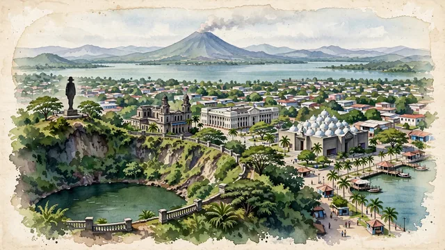
What guided this image
- Landmarks
- Old Cathedral of Managua; Palacio Nacional de la Cultura; Tiscapa Lagoon; Lake Xolotlán; Metropolitan Cathedral; Puerto Salvador Allende
- Viewpoint
- Favor an elevated viewpoint looking north toward Lake Xolotlán (such as from the ridge of the Tiscapa Historical Park), capturing the crater lagoon in the foreground/middle-ground, the historic center around Plaza de la Revolución, the lake, and the distant silhouette of Momotombo volcano.
- Palette
- Green should be the predominant color, especially in the crater slopes of Tiscapa Lagoon, lakefront parks, urban tree canopies, and surrounding volcanic hills.
- Guarded against
- Not a generic Central American city
Population973,087Wikidata: 38,662
Coordinates12.13°N, 86.25°W
Elevation83 m
Area267 km²
Time zoneAmerica/ManaguaUTC−6
Solar noon11:45clock runs 0.2 h behind the sun
Through the Earth
Dig straight through the Earth from Managua and you surface nearest to West Island, Cocos (Keeling) Islands — 334 km from the exact antipodal point.
Nearest cities in the atlas
| Tegucigalpa | HN | 240 km |
| San José | CR | 340 km |
| San Salvador | SV | 363 km |
| Guatemala City | GT | 539 km |
| Belmopan | BZ | 630 km |
| Panama City | PA | 814 km |
| Mérida | MX | 1,046 km |
| Kingston | JM | 1,207 km |
Twinned cities
- Buenos Aires AR
- Caracas VE
- Los Angeles US
- Madrid ES
- Montréal CA
- Quito EC
- Rio de Janeiro BR
- Santo Domingo DO
- Taipei TW
9 of 12 twinned cities are in this atlas. See the full network →