
City
San Salvador
Capital of El Salvador
What guided this image
- Landmarks
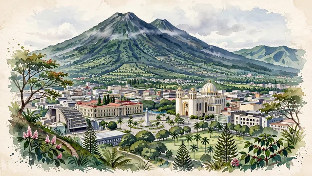
- San Salvador Volcano; Metropolitan Cathedral of the Holy Savior; Palacio Nacional; Church of the Rosary; Divine Savior of the World; Cuscatlán Park; native tropical flora
- Viewpoint
- Favor an elevated viewpoint overlooking the city from the south (such as from the slopes of the Cordillera del Bálsamo or the heights of Los Planes de Renderos), looking north across the city toward the downtown core, with the massive volcanic cone of El Boquerón dominating the entire background.
- Palette
- Green should be the predominant color, especially in the towering forested slopes of the San Salvador Volcano, shade coffee groves, and urban park canopies.
- Guarded against
- Not a generic Central American town
Population525,990Wikidata: 415,346
Coordinates13.69°N, 89.19°W
Elevation670 m
Area72 km²
Time zoneAmerica/El_SalvadorUTC−6
Solar noon11:57clock runs 0.1 h behind the sun
Through the Earth
Dig straight through the Earth from San Salvador and you surface in open ocean, nearest to West Island, Cocos (Keeling) Islands — 673 km from the exact antipodal point.
Nearest cities in the atlas
| Guatemala City | GT | 177 km |
| Tegucigalpa | HN | 218 km |
| Managua | NI | 363 km |
| Belmopan | BZ | 399 km |
| San José | CR | 696 km |
| Mérida | MX | 811 km |
| Puebla | MX | 1,131 km |
| Panama City | PA | 1,176 km |
Twinned cities
- Caracas VE
- Madrid ES
- Mexico City MX
- Monterrey MX
- Montréal CA
- Quito EC
- Santo Domingo DO
- Taipei TW
- Washington US
9 of 9 twinned cities are in this atlas. See the full network →
This city sits on
- El Salvadorcountry
- 13Nparallel
- UTC−6offset