
City
Monterrey
Mexico
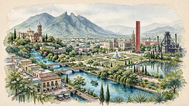
What guided this image
- Landmarks
- Cerro de la Silla; Paseo Santa Lucía; Macroplaza; Palacio del Obispado; Parque Fundidora; Barrio Antiguo; lush northern Mexican montane and semi-arid flora
- Viewpoint
- Favor the classic viewpoint looking across the landscape toward the signature landmarks of Monterrey, showing regional foliage and foreground textures, the iconic architectural monuments in the middle-ground, and the distant horizon fading in the background.
- Palette
- Green should be the predominant color, especially in sabino cypresses along the canal, anacahuita trees, and mountain shrubs.
Population1,135,512
Coordinates25.68°N, 100.32°W
Elevation546 m
Area970 km²
Time zoneAmerica/MonterreyUTC−6
Solar noon12:41clock runs 0.7 h ahead of the sun
Through the Earth
Dig straight through the Earth from Monterrey and you surface in open ocean, nearest to Port Mathurin, Mauritius — 1,795 km from the exact antipodal point.
Nearest cities in the atlas
| San Antonio | US | 453 km |
| León de los Aldama | MX | 526 km |
| Santiago de Querétaro | MX | 566 km |
| Zapopan | MX | 634 km |
| Guadalajara | MX | 636 km |
| Houston | US | 666 km |
| Ecatepec de Morelos | MX | 688 km |
| Mexico City | MX | 706 km |
Twinned cities
- Arequipa PE
- Barcelona ES
- Cali CO
- Canberra AU
- Cape Town ZA
- Dallas US
- Dubai AE
- Fort Worth US
- Guatemala City GT
- Houston US
- Maracaibo VE
- Medellín CO
- Mexico City MX
- Montréal CA
- Munich DE
- San Antonio US
- San Salvador SV
- São Paulo BR
- Shenyang CN
- Surabaya ID
- Valencia VE
21 of 44 twinned cities are in this atlas. See the full network →