
City
Arequipa
Peru
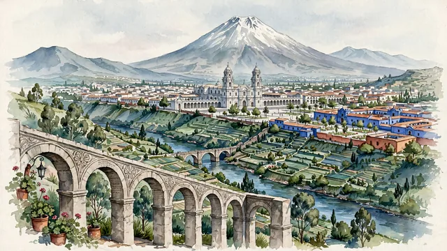
What guided this image
- Landmarks
- Basilica Cathedral of Arequipa; Misti; Yanahuara Mirador; Santa Catalina Monastery; Chili River; Andean
- Viewpoint
- Favor the classic elevated viewpoint from the Yanahuara Mirador looking southeast across the Chili River valley toward central Arequipa and El Misti, showing stone arches and flowering plants in the foreground, the cathedral towers and white sillar roofs in the middle-ground, and the colossal cone of El Misti commanding the background.
- Palette
- Green should be the predominant color, especially in the terraced agricultural fields of the Chili River valley, eucalyptus trees, and palm-filled plaza gardens.
- Guarded against
- Avoid confusing Arequipa with Cusco (no Inca polygonal stone walls; Arequipa is famous for its white volcanic sillar stone).
Population1,008,290
Coordinates16.40°S, 71.54°W
Elevation2,335 m
Area650 km²
Time zoneAmerica/LimaUTC−5
Solar noon11:46clock runs 0.2 h behind the sun
Through the Earth
Dig straight through the Earth from Arequipa and you surface nearest to An Hải, Vietnam — 44 km from the exact antipodal point.
Nearest cities in the atlas
| La Paz | BO | 362 km |
| Sucre | BO | 727 km |
| Lima | PE | 765 km |
| Callao | PE | 773 km |
| Santa Cruz de la Sierra | BO | 902 km |
| Asunción | PY | 1,747 km |
| Guayaquil | EC | 1,824 km |
| Córdoba | AR | 1,827 km |
Twinned cities
- Guadalajara MX
- Guangzhou CN
- La Paz BO
- London GB
- Mexico City MX
- Monterrey MX
- São Paulo BR
- Zibo CN
8 of 20 twinned cities are in this atlas. See the full network →