
City
La Paz
Capital of Bolivia
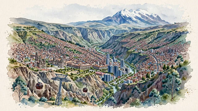
What guided this image
- Landmarks
- Mount Illimani; Metropolitan Cathedral and the Presidential Palace; Valle de la Luna; Basilica of San Francisco; Andean
- Viewpoint
- Favor a high elevated viewpoint from the canyon rim or a scenic mirador (such as Mirador Killi Killi or the edge of El Alto), looking southeast down into the vast urban amphitheater, with the downtown skyscrapers on the basin floor and the snow-crested mass of Mount Illimani anchoring the background.
- Palette
- Green should be the predominant color, especially in the eucalyptus groves of the canyon floor, public plazas, and green hillside terraces.
- Guarded against
- Not a generic South American or Andean town
Population2,004,652Wikidata: 2,867,504
Coordinates16.50°S, 68.15°W
Elevation3,640 m
Area472 km²
Time zoneAmerica/La_PazUTC−4
Solar noon12:33clock runs 0.5 h ahead of the sun
Through the Earth
Dig straight through the Earth from La Paz and you surface nearest to Sansha, China — 64 km from the exact antipodal point.
Nearest cities in the atlas
| Arequipa | PE | 362 km |
| Sucre | BO | 416 km |
| Santa Cruz de la Sierra | BO | 547 km |
| Lima | PE | 1,078 km |
| Callao | PE | 1,087 km |
| Asunción | PY | 1,463 km |
| Córdoba | AR | 1,706 km |
| Manaus | BR | 1,735 km |
Twinned cities
- Arequipa PE
- Asunción PY
- Bogotá CO
- Buenos Aires AR
- Caracas VE
- Dalian CN
- Havana CU
- London GB
- Madrid ES
- Mexico City MX
- Montevideo UY
- Moscow RU
- New York City US
- Quito EC
- Rio de Janeiro BR
- Santiago CL
- Santo Domingo DO
- São Paulo BR
- Taipei TW
- Vaduz LI
- Washington US
- Zagreb HR
22 of 40 twinned cities are in this atlas. See the full network →