
City
Zagreb
Capital of Croatia
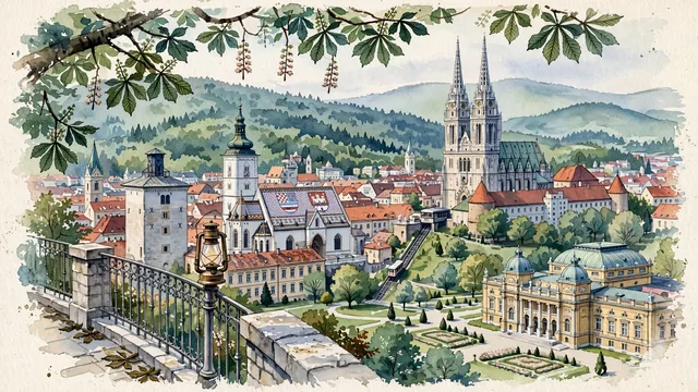
What guided this image
- Landmarks
- St. Mark's Church; Zagreb Cathedral; Lotrščak Tower; Zagreb Funicular; Croatian National Theatre; Upper Town; Mount Medvednica; Central European
- Viewpoint
- Favor the classic elevated viewpoint from the Strossmayer Promenade or Gradec viewpoint looking northeast toward Kaptol and the Cathedral, or looking north toward Gradec with St. Mark's roof and the Lotrščak Tower, showing chestnut tree branches in the foreground, historic rooftops and spires in the middle-ground, and the gentle green ridge of Mount Medvednica in the background.
- Palette
- Green should be the predominant color, especially in the thick beech and oak forests of Mount Medvednica, the Lenuzzi Horseshoe parks (Zrinjevac), and the chestnut trees along the Strossmayer Promenade.
- Guarded against
- Not a generic Central European or Adriatic coastal town
Population663,592Wikidata: 790,017
Coordinates45.81°N, 15.98°E
Elevation127 m
Area641 km²
Time zoneEurope/ZagrebUTC+1
Solar noon11:56clock runs 0.1 h behind the sun
Through the Earth
Dig straight through the Earth from Zagreb and you surface in open ocean, nearest to Waitangi, New Zealand — 1,008 km from the exact antipodal point.
Nearest cities in the atlas
| Ljubljana | SI | 117 km |
| Vienna | AT | 269 km |
| Bratislava | SK | 274 km |
| Sarajevo | BA | 288 km |
| Budapest | HU | 300 km |
| Pest | HU | 302 km |
| San Marino | SM | 347 km |
| Belgrade | RS | 369 km |
Twinned cities
- Budapest HU
- Buenos Aires AR
- Kyoto JP
- La Paz BO
- Lisbon PT
- Ljubljana SI
- London GB
- Podgorica ME
- Saint Petersburg RU
- Sarajevo BA
- Shanghai CN
- Skopje MK
- Tirana AL
- Vienna AT
- Warsaw PL
15 of 25 twinned cities are in this atlas. See the full network →