
City
Vienna
Capital of Austria
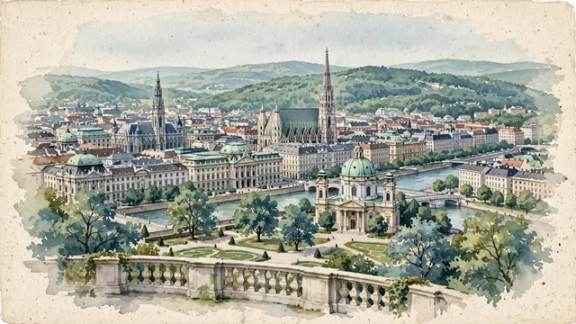
What guided this image
- Landmarks
- Ringstraße; Hofburg Palace; Karlskirche; Danube Canal; Baroque and Biedermeier
- Viewpoint
- Favor a slightly elevated viewpoint looking north-west toward the historic Innere Stadt (such as from the upper terrace of Belvedere Palace or an elevated vantage above the Ringstraße), where the towering spire of Stephansdom and imperial domes rise above the stately urban roofline against the green backdrop of the Wienerwald hills.
- Palette
- Green should be the predominant color, especially in the copper-green oxidized domes, the lush parks and tree-lined Ringstraße, and the rolling forested slopes of the Wienerwald.
- Guarded against
- Avoid making Vienna look like Budapest (no giant riverside Parliament building), Prague (no Charles Bridge with Baroque statues), or Salzburg.
Population1,691,468Wikidata: 1,973,403
Coordinates48.21°N, 16.37°E
Elevation151 m
Area415 km²
Time zoneEurope/ViennaUTC+1
Solar noon11:55clock runs 0.1 h behind the sun
Through the Earth
Dig straight through the Earth from Vienna and you surface in open ocean, nearest to Waitangi, New Zealand — 1,102 km from the exact antipodal point.
Nearest cities in the atlas
| Bratislava | SK | 55 km |
| Budapest | HU | 214 km |
| Pest | HU | 217 km |
| Prague | CZ | 253 km |
| Zagreb | HR | 269 km |
| Ljubljana | SI | 278 km |
| Munich | DE | 355 km |
| Belgrade | RS | 492 km |
Twinned cities
- Belgrade RS
- Bern CH
- Brasília BR
- Bratislava SK
- Budapest HU
- Istanbul TR
- Kyiv UA
- Ljubljana SI
- Moscow RU
- Odesa UA
- Sofia BG
- Tunis TN
- Vaduz LI
- Warsaw PL
- Zagreb HR
15 of 18 twinned cities are in this atlas. See the full network →