
City
Istanbul
Turkey
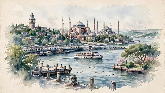
What guided this image
- Landmarks
- Hagia Sophia; Blue Mosque; Galata Tower; Golden Horn and Bosphorus Strait; Galata Bridge; Topkapı Palace; July Martyrs Bridge; lush Bosphorus flora
- Viewpoint
- Favor the classic viewpoint looking across the Golden Horn from Karaköy or Galata toward the Historic Peninsula of Sultanahmet, showing ferry pier railings and gulls in the foreground, a traditional white Bosphorus ferry navigating the water in the middle-ground, and the majestic imperial skyline of Hagia Sophia and the Blue Mosque crowned with minarets rising against the soft sky in the background.
- Palette
- Green should be the predominant color, especially in the thick plane trees and cypresses of Gülhane Park and Topkapı, maritime pines along the Bosphorus shores, and Sultanahmet gardens.
- Guarded against
- Not Ankara, Izmir, or Athens
Population15,701,602Wikidata: 15,655,924
Coordinates41.01°N, 28.95°E
Elevation100 m
Area5,343 km²
Time zoneEurope/IstanbulUTC+3
Solar noon13:04clock runs 1.1 h ahead of the sun
Through the Earth
Dig straight through the Earth from Istanbul and you surface in open ocean, nearest to Mataura, French Polynesia — 1,969 km from the exact antipodal point.
Nearest cities in the atlas
| Bursa | TR | 91 km |
| İzmir | TR | 328 km |
| Ankara | TR | 351 km |
| Bucharest | RO | 445 km |
| Konya | TR | 462 km |
| Antalya | TR | 480 km |
| Sofia | BG | 503 km |
| Athens | GR | 560 km |
Twinned cities
- Almaty KZ
- Amman JO
- Bangkok TH
- Barcelona ES
- Beirut LB
- Berlin DE
- Busan KR
- Cairo EG
- Damascus SY
- Dubai AE
- Giza EG
- Guangzhou CN
- Houston US
- Jakarta ID
- Jeddah SA
- Karachi PK
- Kazan RU
- Khartoum SD
- Köln DE
- Lahore PK
- Mexico City MX
- N'Djamena TD
- Nicosia CY
- Odesa UA
- Rabat MA
- Rio de Janeiro BR
- Saint Petersburg RU
- Sarajevo BA
- Shanghai CN
- Skopje MK
- Tabriz IR
- Tbilisi GE
- Tunis TN
- Warsaw PL
34 of 44 twinned cities are in this atlas. See the full network →