
City
Beirut
Capital of Lebanon
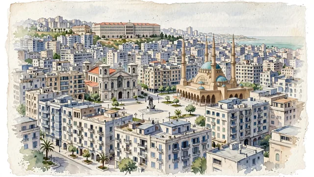
What guided this image
- Landmarks
- Mohammad Al-Amin Mosque; Saint George Maronite Cathedral; Martyrs’ Square; The Grand Serail; Ottoman and French-Mandate-era
- Viewpoint
- Use a slightly raised view from the northeastern side of the central district toward Martyrs’ Square and the higher city to the west, widening the familiar mosque-and-cathedral view while keeping the sea behind or beside the viewer rather than inventing it inland.
- Palette
- Muted botanical green should lead the actual planted pockets and cool reflections, supported by blue-grey roofs and slate-grey urban shadows; keep the dense pale city dominant rather than adding vegetation to fill it.
- Guarded against
- Avoid making Beirut look like Santorini with island cliffs and uniform white houses, Dubai with a continuous new-glass skyline, or a cedar-covered mountain village.
Population1,916,100Wikidata: 361,366
Coordinates33.89°N, 35.50°E
Elevation0 m
Area20 km²
Time zoneAsia/BeirutUTC+2
Solar noon11:38clock runs 0.4 h behind the sun
Through the Earth
Dig straight through the Earth from Beirut and you surface in open ocean, nearest to Mataura, French Polynesia — 1,268 km from the exact antipodal point.
Nearest cities in the atlas
| Damascus | SY | 84 km |
| Amman | JO | 219 km |
| Ramallah | PS | 223 km |
| East Jerusalem | PS | 236 km |
| Jerusalem | IL | 237 km |
| Nicosia | CY | 243 km |
| Aleppo | SY | 298 km |
| Adana | TR | 345 km |
Twinned cities
- Amman JO
- Athens GR
- Baghdad IQ
- Buenos Aires AR
- Cairo EG
- Damascus SY
- Dubai AE
- Istanbul TR
- Karachi PK
- Los Angeles US
- Mexico City MX
- Montréal CA
- Moscow RU
- Rio de Janeiro BR
- Tripoli LY
- Yerevan AM
16 of 22 twinned cities are in this atlas. See the full network →