
City
Baghdad
Capital of Iraq
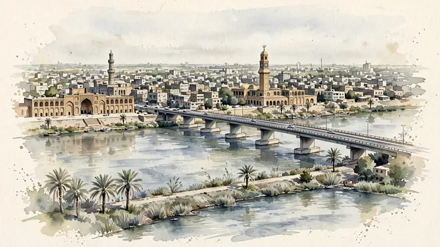
What guided this image
- Landmarks
- The Qushla; The Mustansiriyya Madrasa; Al-Shuhada Bridge; Old Rusafa and the Mutanabbi Street area; Al-Shaheed Monument
- Viewpoint
- Use a slightly elevated view from the Karkh bank across the Tigris toward the old Rusafa frontage, favoring the city’s real river-and-brick identity over a disconnected montage of modern monuments.
- Palette
- For this arid city, explicitly shift the greens toward grey-green, olive, dusty sage and pale khaki; cool sand-beige brickwork, slate-grey shadows and blue-grey river washes should predominate, with palms forming limited olive accents.
- Guarded against
- Avoid making Baghdad look like Babylon with the Ishtar Gate, Samarra with its spiral minaret, or a fantasy Arabian Nights city of oversized onion domes.
Population7,216,000Wikidata: 8,126,755
Coordinates33.34°N, 44.40°E
Elevation34 m
Area673 km²
Time zoneAsia/BaghdadUTC+3
Solar noon12:02clock runs 0.0 h ahead of the sun
Through the Earth
Dig straight through the Earth from Baghdad and you surface in open ocean, nearest to Adamstown, Pitcairn Islands — 1,063 km from the exact antipodal point.
Nearest cities in the atlas
| Sadr City | IQ | 8 km |
| Karbala | IQ | 88 km |
| Kirkuk | IQ | 237 km |
| Erbil | IQ | 319 km |
| Al Mawşil al Jadīdah | IQ | 353 km |
| Mosul | IQ | 353 km |
| Basrah | IQ | 448 km |
| Al Başrah al Qadīmah | IQ | 452 km |
Twinned cities
- Amman JO
- Beirut LB
- Cairo EG
- Damascus SY
- Dubai AE
- Gaziantep TR
- Jeddah SA
- Pyongyang KP
- Rabat MA
- Sanaa YE
- Tehran IR
11 of 13 twinned cities are in this atlas. See the full network →