
City
Tehran
Capital of Iran
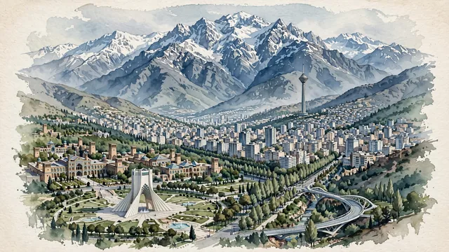
What guided this image
- Landmarks
- Azadi Tower; Milad Tower; Qajar-era Golestan Palace; Tabiat Bridge; Mount Tochal and the Alborz Mountains; Valiasr Street; landscaped urban parklands; Qajar
- Viewpoint
- Favor an elevated panoramic viewpoint looking north toward the Alborz Mountains (such as from the approaches to Azadi Square or the Abbas Abad hills), showing the city's green parks and iconic monuments in the middle-ground, backed by the colossal, snow-capped wall of Mount Tochal filling the upper half of the composition.
- Palette
- Green should be the predominant color, especially in the plane trees along Valiasr Street, parklands, and northern hillside gardens.
- Guarded against
- Not Isfahan, Shiraz, or a generic Arabian city
Population7,153,309Wikidata: 7,711,230
Coordinates35.69°N, 51.42°E
Elevation1,179 m
Area686 km²
Time zoneAsia/TehranUTC+3:30
Solar noon12:04clock runs 0.1 h ahead of the sun
Through the Earth
Dig straight through the Earth from Tehran and you surface in open ocean, nearest to Adamstown, Pitcairn Islands — 1,190 km from the exact antipodal point.
Nearest cities in the atlas
| Karaj | IR | 42 km |
| Isfahan | IR | 339 km |
| Tabriz | IR | 528 km |
| Baku | AZ | 538 km |
| Kirkuk | IQ | 636 km |
| Al Başrah al Qadīmah | IQ | 667 km |
| Basrah | IQ | 668 km |
| Ashgabat | TM | 668 km |
Twinned cities
- Baghdad IQ
- Bangkok TH
- Beijing CN
- Berlin DE
- Brasília BR
- Budapest HU
- Caracas VE
- Dubai AE
- Dushanbe TJ
- Havana CU
- Kabul AF
- Khartoum SD
- Kinshasa CD
- Kuwait City KW
- London GB
- Los Angeles US
- Manila PH
- Minsk BY
- Moscow RU
- Pretoria ZA
- Saint Petersburg RU
- Sanaa YE
- Seoul KR
- Tbilisi GE
24 of 25 twinned cities are in this atlas. See the full network →