
City
Manila
Capital of Philippines
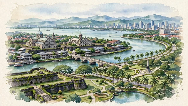
What guided this image
- Landmarks
- Manila Cathedral; San Agustin Church; Pasig River; Rizal Park; Roxas Boulevard; Bahay; Makati and Bonifacio Global City
- Viewpoint
- Favor an elevated viewpoint overlooking Intramuros and Manila Bay (such as from the ramparts of Baluarte de San Diego or looking from Rizal Park across the bay), showing the historic Spanish stone churches and walls in the foreground/middle-ground, with the bay and distant towers balancing the scene.
- Palette
- Green should be the predominant color, especially in the lawns and trees of Rizal Park, mossy Intramuros ramparts, palm-lined boulevards, and tropical gardens.
- Guarded against
- Not a generic Southeast Asian or Latin American city
Population1,600,000Wikidata: 219,928
Coordinates14.60°N, 120.98°E
Elevation9 m
Area25 km²
Time zoneAsia/ManilaUTC+8
Solar noon11:56clock runs 0.1 h behind the sun
Through the Earth
Dig straight through the Earth from Manila and you surface nearest to Conquista d'Oeste, Brazil — 56 km from the exact antipodal point.
Nearest cities in the atlas
| Caloocan | PH | 6 km |
| Quezon City | PH | 9 km |
| Taguig | PH | 14 km |
| Zamboanga | PH | 863 km |
| Kaohsiung | TW | 895 km |
| Budta | PH | 905 km |
| Malingao | PH | 911 km |
| Tainan | TW | 936 km |
Twinned cities
- Astana KZ
- Bangkok TH
- Beijing CN
- Bucharest RO
- Busan KR
- Cali CO
- Fuzhou CN
- Guangzhou CN
- Havana CU
- Ho Chi Minh City VN
- Incheon KR
- Jakarta ID
- Lima PE
- Los Angeles US
- Madrid ES
- Mexico City MX
- Montréal CA
- Moscow RU
- New Delhi IN
- Osaka JP
- Panama City PA
- Santiago CL
- Shanghai CN
- Sydney AU
- Taichung TW
- Taipei TW
- Tehran IR
- Yokohama JP
28 of 45 twinned cities are in this atlas. See the full network →
This city sits on
- Philippinescountry
- 14Nparallel
- UTC+8offset