
City
Astana
Capital of Kazakhstan
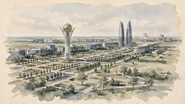
What guided this image
- Landmarks
- Bayterek; Nurzhol Boulevard; Ak Orda; House of Ministries; Khan Shatyr
- Viewpoint
- Use a moderately elevated eastward view along Nurzhol Boulevard toward Bayterek and Ak Orda, a familiar planned-city perspective that should retain its long distances rather than compressing every icon into one block.
- Palette
- For this dry steppe setting, explicitly shift the greens toward grey-green, olive, dusty sage and pale khaki; blue-grey glass and slate-grey urban shadows should carry much of the image, while summer lawn greens remain limited to cultivated areas.
- Guarded against
- Avoid making Astana look like Almaty beneath the Tian Shan, Dubai on a sea coast, or an old Silk Road city of tightly clustered tiled domes.
Population1,544,142Wikidata: 1,078,362
Coordinates51.18°N, 71.45°E
Elevation347 m
Area710,200,000 km²
Time zoneAsia/AlmatyUTC+5
Solar noon12:14clock runs 0.2 h ahead of the sun
Through the Earth
Dig straight through the Earth from Astana and you surface in open ocean, nearest to Puerto Natales, Chile — 2,472 km from the exact antipodal point.
Nearest cities in the atlas
| Omsk | RU | 443 km |
| Chelyabinsk | RU | 800 km |
| Novosibirsk | RU | 876 km |
| Yekaterinburg | RU | 946 km |
| Bishkek | KG | 954 km |
| Almaty | KZ | 973 km |
| Shymkent | KZ | 996 km |
| Ufa | RU | 1,107 km |
Twinned cities
- Amman JO
- Ankara TR
- Bangkok TH
- Beijing CN
- Bishkek KG
- Hanoi VN
- Jakarta ID
- Kazan RU
- Kyiv UA
- Manila PH
- Moscow RU
- Riga LV
- Saint Petersburg RU
- Sarajevo BA
- Seoul KR
- Tbilisi GE
- Vilnius LT
- Warsaw PL
- Yerevan AM
19 of 25 twinned cities are in this atlas. See the full network →
This city sits on
- Kazakhstancountry
- 51Nparallel
- UTC+5offset