
City
Madrid
Capital of Spain
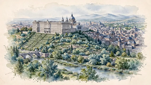
What guided this image
- Landmarks
- Royal Palace; Campo del Moro; Madrid; Madrid's; Gran Vía and Calle de Alcalá; Casa de Campo and El Retiro Park; Puente de Toledo; Habsburg
- Viewpoint
- Favor a slightly elevated viewpoint from the west (near Casa de Campo or the banks of the Manzanares River), looking east/north-east up toward the ridge where the Royal Palace and Almudena Cathedral rise above the terraced green gardens of Campo del Moro, with the dense historic rooftops of Madrid extending eastward and the faint outline of the Sierra de Guadarrama subtle on the northern horizon.
- Palette
- Green should be the predominant color, especially in the tree canopies of Campo del Moro, Casa de Campo, Madrid Río, and the city's parks and gardens.
- Guarded against
- Avoid making Madrid look like Barcelona (no Gaudí curves or Sagrada Família spires), Seville, or coastal Andalusia.
Population3,255,944Wikidata: 3,207,247
Coordinates40.42°N, 3.70°W
Elevation663 m
Area604 km²
Time zoneEurope/MadridUTC+1
Solar noon13:15clock runs 1.2 h ahead of the sun
Through the Earth
Dig straight through the Earth from Madrid and you surface nearest to Dannevirke, New Zealand — 29 km from the exact antipodal point.
Nearest cities in the atlas
| Andorra la Vella | AD | 493 km |
| Lisbon | PT | 503 km |
| Barcelona | ES | 504 km |
| Tangier | MA | 549 km |
| Algiers | DZ | 719 km |
| Fes | MA | 720 km |
| Rabat | MA | 765 km |
| Casablanca | MA | 835 km |
Twinned cities
- Abu Dhabi AE
- Asunción PY
- Athens GR
- Beijing CN
- Berlin DE
- Bogotá CO
- Brussels BE
- Budapest HU
- Buenos Aires AR
- Caracas VE
- Damascus SY
- Guatemala City GT
- Havana CU
- Kyiv UA
- La Paz BO
- Lima PE
- Lisbon PT
- Managua NI
- Manila PH
- Mexico City MX
- Montevideo UY
- Moscow RU
- New York City US
- Nouakchott MR
- Panama City PA
- Prague CZ
- Quito EC
- Rabat MA
- Rio de Janeiro BR
- San José CR
- San Salvador SV
- Santiago CL
- Santo Domingo DO
- Sarajevo BA
- Sofia BG
- Tegucigalpa HN
- Tirana AL
- Tripoli LY
- Warsaw PL
39 of 48 twinned cities are in this atlas. See the full network →