
City
Fes
Morocco
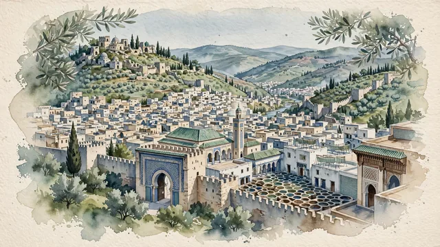
What guided this image
- Landmarks
- Bab Bou Jeloud; Al-Qarawiyyin Mosque and University; Bou Inania Medersa; Chouara Tannery; Marinid Tombs; lush Moroccan foothill flora; Idrisid and Marinid Islamic
- Viewpoint
- Favor the classic viewpoint from the Marinid Tombs overlooking the entire medina basin, or looking through the grand horseshoe arch of Bab Bou Jeloud into the medina, showing olive tree branches and stone battlements in the foreground, the dense sea of whitewashed rooftops, green minarets, and courtyard gardens in the middle-ground, and the rolling Middle Atlas mountain ridges fading in the background.
- Palette
- Green should be the predominant color, especially in the silvery-green olive groves covering the hillsides, cypress spires, and emerald green-glazed tile roofs of Al-Qarawiyyin.
- Guarded against
- Not Marrakech, Casablanca, or Rabat
Population1,191,905Wikidata: 325,327
Coordinates34.03°N, 5.00°W
Elevation408 m
Area320 km²
Time zoneAfrica/CasablancaUTC+1
Solar noon13:20clock runs 1.3 h ahead of the sun
Through the Earth
Dig straight through the Earth from Fes and you surface nearest to Russell, New Zealand — 159 km from the exact antipodal point.
Nearest cities in the atlas
| Rabat | MA | 169 km |
| Tangier | MA | 207 km |
| Casablanca | MA | 246 km |
| Lisbon | PT | 641 km |
| Madrid | ES | 720 km |
| Algiers | DZ | 792 km |
| Barcelona | ES | 1,032 km |
| Andorra la Vella | AD | 1,101 km |
Twinned cities
- Barcelona ES
- Chengdu CN
- East Jerusalem PS
- Lahore PK
- Suwon KR
5 of 22 twinned cities are in this atlas. See the full network →