
City
Algiers
Capital of Algeria
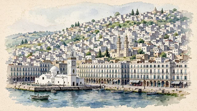
What guided this image
- Landmarks
- The Casbah of Algiers; Ketchaoua Mosque; Djamaa el Djedid, the New Mosque; The nineteenth-century French-built waterfront; Martyrs’ Memorial
- Viewpoint
- Use the conventional harbor-side view looking upslope toward the lower Casbah, representative of the historic maritime core but widened to retain the everyday waterfront blocks and their real density.
- Palette
- Muted botanical green should lead the small planted areas and cool shadows, while white paper and pale neutral masonry retain the city’s essential lightness and blue-green water supplies the broader cool color field.
- Guarded against
- Avoid making Algiers look like Santorini with blue-domed island churches, a flat Casablanca-style waterfront, or an inland Saharan settlement.
Population2,364,230Wikidata: 30,395
Coordinates36.73°N, 3.09°E
Elevation0 m
Area363 km²
Time zoneAfrica/AlgiersUTC+1
Solar noon12:48clock runs 0.8 h ahead of the sun
Through the Earth
Dig straight through the Earth from Algiers and you surface nearest to Hicks Bay, New Zealand — 435 km from the exact antipodal point.
Nearest cities in the atlas
| Barcelona | ES | 524 km |
| Tunis | TN | 631 km |
| Andorra la Vella | AD | 657 km |
| Madrid | ES | 719 km |
| Fes | MA | 792 km |
| Tangier | MA | 804 km |
| Monaco | MC | 861 km |
| Rabat | MA | 948 km |
Twinned cities
- Abu Dhabi AE
- Amman JO
- Amsterdam NL
- Asunción PY
- Barcelona ES
- Beijing CN
- Berlin DE
- Cairo EG
- Caracas VE
- Casablanca MA
- Daejeon KR
- Dakar SN
- London GB
- Montréal CA
- Moscow RU
- New York City US
- Pyongyang KP
- Sofia BG
- Tripoli LY
- Tunis TN
20 of 27 twinned cities are in this atlas. See the full network →