
City
Pyongyang
Capital of North Korea
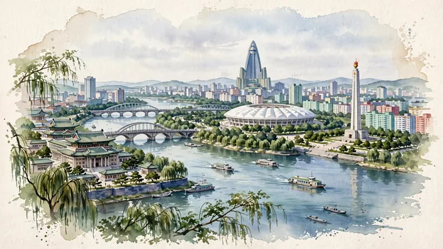
What guided this image
- Landmarks
- Ryugyong Hotel; Juche Tower; Grand People's Study House; Taedong River; Okryu Bridge and Chongryu Bridge; May Stadium
- Viewpoint
- Favor an elevated viewpoint along or across the Taedong River (such as from the bluffs of Moran Hill or the riverbanks near Okryu Bridge), looking south or southwest across the river toward the city center, showing the weeping willows in the foreground, the Juche Tower and Grand People's Study House in the middle-ground, and the pyramid of the Ryugyong Hotel rising in the background.
- Palette
- Green should be the predominant color, especially in the weeping willows along the Taedong River, Moran Hill (Moranbong) parkland, and Rungra Island.
- Guarded against
- Not a generic East Asian or Soviet city
Population3,222,000Wikidata: 2,581,076
Coordinates39.03°N, 125.75°E
Elevation38 m
Area3,194 km²
Time zoneAsia/PyongyangUTC+9
Solar noon12:37clock runs 0.6 h ahead of the sun
Through the Earth
Dig straight through the Earth from Pyongyang and you surface nearest to Mar de las Pampas, Argentina — 307 km from the exact antipodal point.
Nearest cities in the atlas
| Goyang-si | KR | 180 km |
| Incheon | KR | 194 km |
| Seoul | KR | 195 km |
| Suwon | KR | 223 km |
| Anshan | CN | 330 km |
| Daejeon | KR | 331 km |
| Fushun | CN | 353 km |
| Dalian | CN | 359 km |
Twinned cities
7 of 8 twinned cities are in this atlas. See the full network →
This city sits on
- North Koreacountry
- 39Nparallel
- UTC+9offset