
City
Andorra la Vella
Capital of Andorra
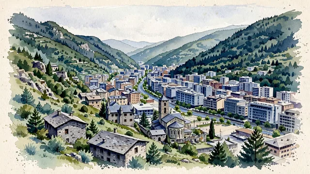
What guided this image
- Landmarks
- Casa de la Vall; Sant Esteve Church; The Barri Antic; Casa de la Vall
- Viewpoint
- Use a moderately elevated view from the Rec del Solà hillside across the old quarter and valley floor, a setting that is more representative than isolating Casa de la Vall and hiding the modern city.
- Palette
- Muted botanical green should predominate on the real mountain slopes, with slate grey in the characteristic roofing and blue-grey in the modern valley-floor buildings.
- Guarded against
- Avoid making Andorra la Vella look like a Swiss chalet village, a flat Castilian town, or a tiny isolated ski resort; do not transplant the Caldea complex from neighboring Escaldes-Engordany into the old quarter.
Population20,430Wikidata: 19,408
Coordinates42.51°N, 1.52°E
Elevation1,022 m
Area30 km²
Time zoneEurope/AndorraUTC+1
Solar noon12:54clock runs 0.9 h ahead of the sun
Through the Earth
Dig straight through the Earth from Andorra la Vella and you surface nearest to Waitangi, New Zealand — 223 km from the exact antipodal point.
Nearest cities in the atlas
| Barcelona | ES | 135 km |
| Madrid | ES | 493 km |
| Monaco | MC | 498 km |
| Algiers | DZ | 657 km |
| Bern | CH | 680 km |
| Milan | IT | 695 km |
| Paris | FR | 708 km |
| Vaduz | LI | 814 km |
Twinned cities
- Mexico City MX
1 of 4 twinned cities are in this atlas. See the full network →