
City
Tirana
Capital of Albania
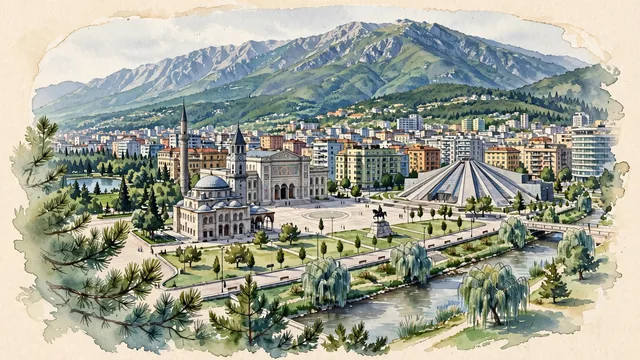
What guided this image
- Landmarks
- National Historical Museum; Et'hem Bey Mosque; Ottoman Clock Tower of Tirana; Skanderbeg Square; Pyramid of Tirana; Lana River; Tirana's; Mount Dajti
- Viewpoint
- Favor an elevated viewpoint overlooking the city from the south or southwest (such as from the Grand Park hills or a central high-rise), looking northeast across Skanderbeg Square toward Mount Dajti, showing the mosque, clock tower, and colorful facades in the middle-ground, backed by the dramatic mountain ridge.
- Palette
- Green should be the predominant color, especially in the thick pine and beech forests of Mount Dajti, the Grand Park, and weeping willows along the Lana River.
- Guarded against
- Not a generic Balkan or Italian town
Population418,495
Coordinates41.33°N, 19.82°E
Elevation110 m
Area42 km²
Time zoneEurope/TiraneUTC+1
Solar noon11:41clock runs 0.3 h behind the sun
Through the Earth
Dig straight through the Earth from Tirana and you surface in open ocean, nearest to Waitangi, New Zealand — 1,369 km from the exact antipodal point.
Nearest cities in the atlas
| Podgorica | ME | 132 km |
| Skopje | MK | 153 km |
| Pristina | XK | 186 km |
| Sarajevo | BA | 305 km |
| Sofia | BG | 327 km |
| Belgrade | RS | 389 km |
| Athens | GR | 501 km |
| Zagreb | HR | 586 km |
Twinned cities
- Ankara TR
- Athens GR
- Barcelona ES
- Beijing CN
- Brussels BE
- Bucharest RO
- Bursa TR
- Doha QA
- Istanbul TR
- Kharkiv UA
- Kyiv UA
- Madrid ES
- Moscow RU
- Paris FR
- Podgorica ME
- Prague CZ
- Pristina XK
- Rome IT
- Sarajevo BA
- Seoul KR
- Skopje MK
- Sofia BG
- Vilnius LT
- Zagreb HR
24 of 46 twinned cities are in this atlas. See the full network →