
City
Brussels
Capital of Belgium
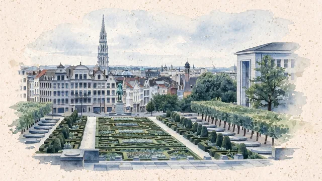
What guided this image
- Landmarks
- Mont des Arts; Brussels Town Hall; The Royal Library of Belgium, KBR; The equestrian statue of Albert I; Medieval
- Viewpoint
- Use the conventional downward view from the upper Mont des Arts terrace toward the lower city and Town Hall spire, a representative transition between civic eras when the library and ordinary rooftops remain present rather than being edited into a purely medieval postcard.
- Palette
- Muted botanical green should predominate in the genuine Mont des Arts garden and tree planting, with slate-grey roofs, blue-grey distance and pale stone keeping the densely built lower city visible.
- Guarded against
- Avoid making Brussels look like Bruges with canals through the center, Amsterdam with continuous narrow canal houses, or Paris with the Eiffel Tower; do not place the distant Atomium beside the Town Hall.
Population1,019,022Wikidata: 176,545
Coordinates50.85°N, 4.35°E
Elevation70 m
Area33 km²
Time zoneEurope/BrusselsUTC+1
Solar noon12:43clock runs 0.7 h ahead of the sun
Through the Earth
Dig straight through the Earth from Brussels and you surface in open ocean, nearest to Waitangi, New Zealand — 770 km from the exact antipodal point.
Nearest cities in the atlas
| Amsterdam | NL | 173 km |
| Köln | DE | 183 km |
| Luxembourg | LU | 187 km |
| Paris | FR | 265 km |
| London | GB | 321 km |
| Birmingham | GB | 467 km |
| Hamburg | DE | 487 km |
| Bern | CH | 489 km |
Twinned cities
- Beijing CN
- Berlin DE
- Brasília BR
- Kyiv UA
- Lagos NG
- Ljubljana SI
- Madrid ES
- Montréal CA
- Moscow RU
- Prague CZ
- Sofia BG
- Tirana AL
- Vilnius LT
- Washington US
14 of 19 twinned cities are in this atlas. See the full network →