
City
Washington
Capital of United States
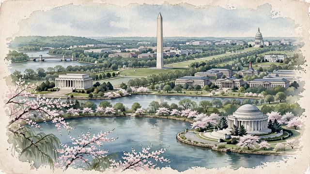
What guided this image
- Landmarks
- Washington Monument; United States Capitol; Lincoln Memorial Reflecting Pool; Thomas Jefferson Memorial; White House; Tidal Basin and the Potomac River; Smithsonian Institution; Arlington Memorial Bridge
- Viewpoint
- Favor the classic elevated viewpoint from across the Tidal Basin or from the western approaches looking east along the National Mall, showing the water and cherry trees in the foreground, the Lincoln Memorial and Washington Monument in the middle-ground, and the US Capitol dome rising gently on the distant horizon.
- Palette
- Green should be the predominant color, especially in the expansive lawns of the National Mall, elms lining Constitution Avenue, cherry trees along the Tidal Basin, and Potomac riverbank woods.
- Guarded against
- Not a generic American city or commercial high-rise skyline
Population689,545Wikidata: 8,144
Coordinates38.90°N, 77.04°W
Elevation72 m
Area177 km²
Time zoneAmerica/New_YorkUTC−5
Solar noon12:08clock runs 0.1 h ahead of the sun
Through the Earth
Dig straight through the Earth from Washington and you surface in open ocean, nearest to Augusta, Australia — 1,201 km from the exact antipodal point.
Nearest cities in the atlas
| Philadelphia | US | 199 km |
| New York City | US | 328 km |
| Brooklyn | US | 328 km |
| Manhattan | US | 335 km |
| Queens | US | 337 km |
| The Bronx | US | 347 km |
| Toronto | CA | 570 km |
| Ottawa | CA | 732 km |
Twinned cities
- Accra GH
- Addis Ababa ET
- Ankara TR
- Athens GR
- Bangkok TH
- Beijing CN
- Brasília BR
- Dakar SN
- Paris FR
- Pretoria ZA
- Rome IT
- San Salvador SV
- Seoul KR
13 of 16 twinned cities are in this atlas. See the full network →
This city sits on
- United Statescountry
- 38Nparallel
- UTC−5offset