
City
Pretoria
Capital of South Africa
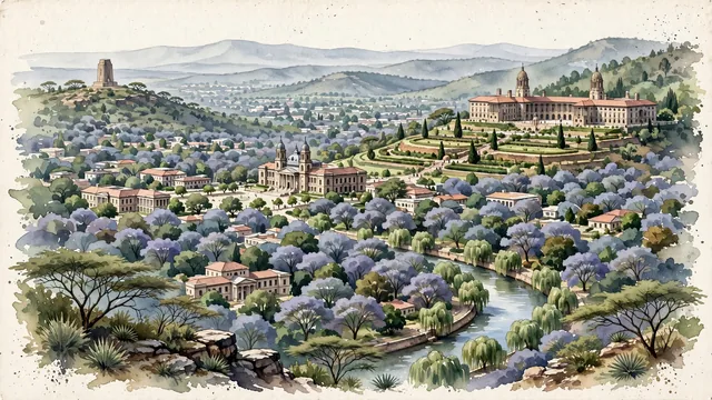
What guided this image
- Landmarks
- Sir Herbert Baker; Church Square; Voortrekker Monument; Meintjieskop; Apies River; Cape Dutch
- Viewpoint
- Favor an elevated viewpoint from the opposite ridge looking north across the valley toward Meintjieskop, showing the sea of tree canopies in the foreground/middle-ground, with the grand curved facade and twin domes of the Union Buildings rising majestically on the hillside terrace, backed by the soft blue-gray ridges of the Magaliesberg.
- Palette
- Green should be the predominant color, especially in the lush valley tree canopies, terraced gardens of the Union Buildings, and the surrounding Magaliesberg bushveld slopes.
- Guarded against
- Avoid confusing Pretoria with Johannesburg (no gold mine dumps or dense skyscraper canyons) or Cape Town (no Table Mountain or ocean bays).
Population2,112,693Wikidata: 741,651
Coordinates25.74°S, 28.19°E
Elevation1,339 m
Area688 km²
Time zoneAfrica/JohannesburgUTC+2
Solar noon12:07clock runs 0.1 h ahead of the sun
Through the Earth
Dig straight through the Earth from Pretoria and you surface in open ocean, nearest to Hana, United States — 699 km from the exact antipodal point.
Nearest cities in the atlas
| Johannesburg | ZA | 53 km |
| Soweto | ZA | 68 km |
| Gaborone | BW | 259 km |
| Mbabane | SZ | 301 km |
| Lobamba | SZ | 311 km |
| Maseru | LS | 404 km |
| Bloemfontein | ZA | 424 km |
| Matola | MZ | 428 km |
Twinned cities
- Amman JO
- Baku AZ
- Johannesburg ZA
- Kyiv UA
- Port Louis MU
- Quito EC
- Taipei TW
- Tehran IR
- Washington US
9 of 11 twinned cities are in this atlas. See the full network →
This city sits on
- South Africacountry
- 26Sparallel
- UTC+2offset