
City
Brooklyn
United States
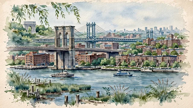
What guided this image
- Landmarks
- Brooklyn Bridge; DUMBO; Brooklyn Bridge Park; Brooklyn Heights; Grand Army Plaza; East River; East River; lush urban greenery
- Viewpoint
- Favor the classic viewpoint from Brooklyn Bridge Park or the Brooklyn Heights Promenade looking toward the Brooklyn Bridge and DUMBO, showing shoreline park grasses and wooden pilings in the foreground, the stone arches of the bridge and converted red-brick warehouses in the middle-ground, and the East River and soft city horizon in the background.
- Palette
- Green should be the predominant color, especially in the lush canopies of Brooklyn Bridge Park, Prospect Park, and street-lining plane trees.
- Guarded against
- Not Manhattan, Queens, or Chicago
Population2,736,074Wikidata: 2,504,700
Coordinates40.65°N, 73.95°W
Area251 km²
Time zoneAmerica/New_YorkUTC−5
Solar noon11:56clock runs 0.1 h behind the sun
Through the Earth
Dig straight through the Earth from Brooklyn and you surface in open ocean, nearest to Augusta, Australia — 1,067 km from the exact antipodal point.
Nearest cities in the atlas
| New York City | US | 8 km |
| Queens | US | 10 km |
| Manhattan | US | 15 km |
| The Bronx | US | 23 km |
| Philadelphia | US | 129 km |
| Washington | US | 328 km |
| Montréal | CA | 541 km |
| Ottawa | CA | 548 km |
Twinned cities
- Yiwu CN
1 of 10 twinned cities are in this atlas. See the full network →
This city sits on
- United Statescountry
- 40Nparallel
- UTC−5offset