
City
San José
Capital of Costa Rica
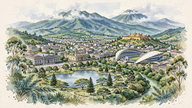
What guided this image
- Landmarks
- National Theatre of Costa Rica; Metropolitan Cathedral of San José; Bellavista Fortress; Sabana Metropolitan Park; National Stadium of Costa Rica; Barrio Amón; Torres River and María Aguilar River; Costa Rican
- Viewpoint
- Favor an elevated viewpoint overlooking the city from the hills of Escazú or near La Sabana Park looking northeast, showing the lush park trees in the foreground, the historic downtown with the National Theatre and cathedral in the middle-ground, and the massive volcanic ridges of Barva and Irazú dominating the background.
- Palette
- Green should be the predominant color, especially in the towering forested volcanic ridges of the Cordillera Central, the vast tree canopies of Parque La Sabana, and coffee-covered hillsides.
- Guarded against
- Not a generic Latin American town or tropical beach
Population335,007Wikidata: 288,054
Coordinates9.93°N, 84.08°W
Elevation1,161 m
Area45 km²
Time zoneAmerica/Costa_RicaUTC−6
Solar noon11:36clock runs 0.4 h behind the sun
Through the Earth
Dig straight through the Earth from San José and you surface nearest to West Island, Cocos (Keeling) Islands — 267 km from the exact antipodal point.
Nearest cities in the atlas
| Managua | NI | 340 km |
| Panama City | PA | 511 km |
| Tegucigalpa | HN | 573 km |
| San Salvador | SV | 696 km |
| Guatemala City | GT | 873 km |
| Belmopan | BZ | 958 km |
| Medellín | CO | 1,022 km |
| Barranquilla | CO | 1,023 km |
Twinned cities
- Beijing CN
- Guatemala City GT
- Lima PE
- Madrid ES
- Rio de Janeiro BR
- Santiago CL
- Santo Domingo DO
- Taipei TW
8 of 21 twinned cities are in this atlas. See the full network →
This city sits on
- Costa Ricacountry
- 9Nparallel
- UTC−6offset