
City
Panama City
Capital of Panama
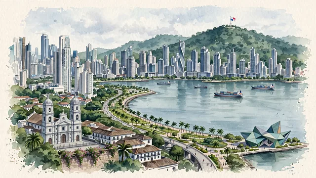
What guided this image
- Landmarks
- Casco Viejo; Metropolitan Cathedral; Cinta Costera; Cerro Ancón; Bella Vista and Punta Paitilla; Frank Gehry; Panama Canal; tropical greenery
- Viewpoint
- Favor an elevated coastal viewpoint looking from the Amador Causeway or the ramparts of Casco Viejo (Plaza de Francia) across the bay, capturing the historic colonial rooftops in the foreground/middle-ground, the Cinta Costera curving over the water, and the modern skyscraper skyline rising across the bay, backed by Cerro Ancón.
- Palette
- Green should be the predominant color, especially in the thick rainforest of Cerro Ancón, coastal parks of the Cinta Costera, and tropical garden trees.
- Guarded against
- Not a generic Central American city or Miami replica
Population408,168Wikidata: 1,540,000
Coordinates8.99°N, 79.52°W
Elevation20 m
Area275 km²
Time zoneAmerica/PanamaUTC−5
Solar noon12:18clock runs 0.3 h ahead of the sun
Through the Earth
Dig straight through the Earth from Panama City and you surface in open ocean, nearest to West Island, Cocos (Keeling) Islands — 533 km from the exact antipodal point.
Nearest cities in the atlas
| San José | CR | 511 km |
| Medellín | CO | 531 km |
| Barranquilla | CO | 564 km |
| Cali | CO | 702 km |
| Bogotá | CO | 773 km |
| Managua | NI | 814 km |
| Maracaibo | VE | 886 km |
| Tegucigalpa | HN | 1,011 km |
Twinned cities
- Barranquilla CO
- Callao PE
- Guadalajara MX
- Incheon KR
- Madrid ES
- Manila PH
- Mexico City MX
- San Diego US
- Taipei TW
9 of 14 twinned cities are in this atlas. See the full network →