
City
Caloocan
Philippines
What guided this image
- Landmarks
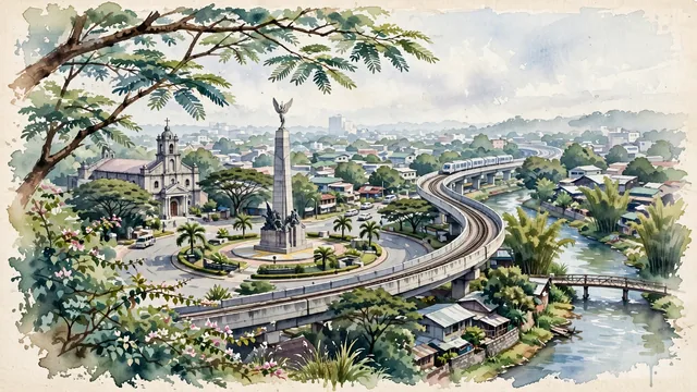
- Bonifacio Monument; Diocesan Shrine and Parish of Our Lady of Grace; Tullahan River; traditional Filipino residential streetscapes; lush tropical flora; Philippine Katipunan
- Viewpoint
- Favor an elevated viewpoint overlooking Monumento Circle from an adjacent building or avenue approach, showing lush tree canopies and street edges in the foreground, the soaring Bonifacio obelisk and circular park in the middle-ground, and the low-rise urban roofscape fading softly into the distant horizon.
- Palette
- Green should be the predominant color, especially in the thick canopies of acacia and narra trees around Monumento circle, parklands, and riverside bamboo.
- Guarded against
- Not central Manila, Quezon City, or Makati
Population1,712,945Wikidata: 7,847
Coordinates14.65°N, 120.97°E
Elevation30 m
Area56 km²
Time zoneAsia/ManilaUTC+8
Solar noon11:56clock runs 0.1 h behind the sun
Through the Earth
Dig straight through the Earth from Caloocan and you surface nearest to Conquista d'Oeste, Brazil — 56 km from the exact antipodal point.
Nearest cities in the atlas
| Manila | PH | 6 km |
| Quezon City | PH | 9 km |
| Taguig | PH | 19 km |
| Zamboanga | PH | 869 km |
| Kaohsiung | TW | 889 km |
| Budta | PH | 911 km |
| Malingao | PH | 917 km |
| Tainan | TW | 931 km |
Twinned cities
Wikidata records no twinned cities for Caloocan inside this atlas.
This city sits on
- Philippinescountry
- 14Nparallel
- UTC+8offset