
City
Busan
South Korea
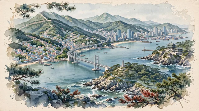
What guided this image
- Landmarks
- Gwangan Bridge; Haedong Yonggungsa Temple; Gamcheon Culture Village; Jagalchi Market; Marine City; Dongbaekseom Island; steep forested granite peaks
- Viewpoint
- Favor the classic coastal viewpoint from Dongbaekseom Island or Gwangalli Beach looking toward Gwangan Bridge and the Haeundae coastline, showing coastal pine branches and granite rocks in the foreground, the sweeping suspension bridge over the water in the middle-ground, and the rugged, forested mountain ridges rising into the background.
- Palette
- Green should be the predominant color, especially in the thick Korean red pine forests covering Dongbaekseom Island and the coastal mountains.
- Guarded against
- Avoid confusing Busan with Seoul (no Han River or N Seoul Tower; Busan is defined by coastal bays, the Gwangan suspension bridge, and sea-cliff temples).
Population3,285,147Wikidata: 3,453,198
Coordinates35.10°N, 129.03°E
Elevation30 m
Area770 km²
Time zoneAsia/SeoulUTC+9
Solar noon12:24clock runs 0.4 h ahead of the sun
Through the Earth
Dig straight through the Earth from Busan and you surface nearest to Barra del Chuy, Uruguay — 267 km from the exact antipodal point.
Nearest cities in the atlas
| Changwon | KR | 35 km |
| Ulsan | KR | 56 km |
| Daegu | KR | 94 km |
| Gwangju | KR | 192 km |
| Daejeon | KR | 204 km |
| Fukuoka | JP | 210 km |
| Suwon | KR | 304 km |
| Hiroshima | JP | 322 km |
Twinned cities
- Auckland NZ
- Bangkok TH
- Barcelona ES
- Casablanca MA
- Chicago US
- Dubai AE
- Fukuoka JP
- Ho Chi Minh City VN
- Istanbul TR
- Kaohsiung TW
- Los Angeles US
- Manila PH
- Montréal CA
- Rio de Janeiro BR
- Saint Petersburg RU
- Shanghai CN
- Surabaya ID
- Tijuana MX
- Yokohama JP
19 of 27 twinned cities are in this atlas. See the full network →
This city sits on
- South Koreacountry
- 35Nparallel
- UTC+9offset