
City
Mosul
Iraq
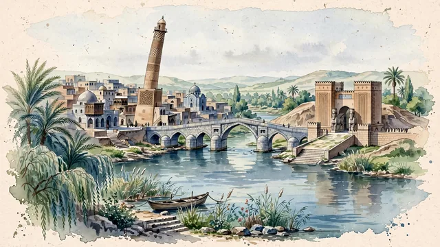
What guided this image
- Landmarks
- Great Mosque; Nergal Gate; Old Stone Bridge; Mar Thomas Syrian Orthodox Church; Old Mosul; Tigris River; lush Upper Mesopotamian riverine flora; Neo-Assyrian
- Viewpoint
- Favor the classic viewpoint looking across the landscape toward the signature landmarks of Mosul, showing regional foliage and foreground textures, the iconic architectural monuments in the middle-ground, and the distant horizon fading in the background.
- Palette
- Green should be the predominant color, especially in thick date palms and willows along the Tigris, and orchard greenery.
Population1,683,000Wikidata: 1,800,000
Coordinates36.34°N, 43.12°E
Elevation223 m
Area180 km²
Time zoneAsia/BaghdadUTC+3
Solar noon12:08clock runs 0.1 h ahead of the sun
Through the Earth
Dig straight through the Earth from Mosul and you surface in open ocean, nearest to Adamstown, Pitcairn Islands — 1,410 km from the exact antipodal point.
Nearest cities in the atlas
| Al Mawşil al Jadīdah | IQ | 1 km |
| Erbil | IQ | 82 km |
| Kirkuk | IQ | 150 km |
| Diyarbakır | TR | 311 km |
| Tabriz | IR | 341 km |
| Sadr City | IQ | 350 km |
| Baghdad | IQ | 353 km |
| Karbala | IQ | 422 km |
Twinned cities
- Philadelphia US
1 of 1 twinned cities are in this atlas. See the full network →