
City
Antalya
Turkey
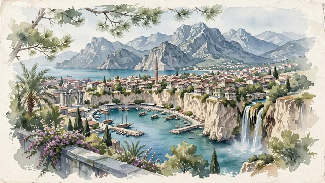
What guided this image
- Landmarks
- Yivliminare Mosque; Hadrian's Gate; Kaleiçi; Lower Düden Waterfalls; lush Mediterranean greenery; Beydağları; Seljuk Islamic
- Viewpoint
- Favor the classic elevated viewpoint from Karaalioğlu Park or the clifftop terrace looking northwest across the historic harbour toward Kaleiçi and the Beydağları, showing stone pine branches in the foreground, the harbour basin, wooden gulets, and Yivli Minare in the middle-ground, and the towering mountain wall in the background.
- Palette
- Green should be the predominant color, especially in the stone pines along the clifftop parks (Karaalioğlu Park), date palms, and Mediterranean shrublands.
- Guarded against
- Not Istanbul, Bodrum, or a generic Mediterranean resort
Population1,335,002Wikidata: 2,426,356
Coordinates36.91°N, 30.70°E
Elevation30 m
Area1,417 km²
Time zoneEurope/IstanbulUTC+3
Solar noon12:57clock runs 1.0 h ahead of the sun
Through the Earth
Dig straight through the Earth from Antalya and you surface in open ocean, nearest to Mataura, French Polynesia — 1,508 km from the exact antipodal point.
Nearest cities in the atlas
| Konya | TR | 190 km |
| Nicosia | CY | 307 km |
| İzmir | TR | 355 km |
| Ankara | TR | 384 km |
| Bursa | TR | 393 km |
| Adana | TR | 411 km |
| Kayseri | TR | 467 km |
| Istanbul | TR | 480 km |
Twinned cities
8 of 26 twinned cities are in this atlas. See the full network →